-
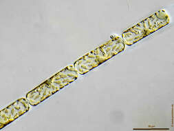
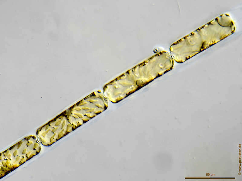
D. fragilissimus forms loosely connected chains. The cells bear processes on the valve end which fit into depressions on the adjacent cell. It is often found together with Leptocylindrus danicus and Guinardia delicatula
-
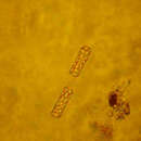
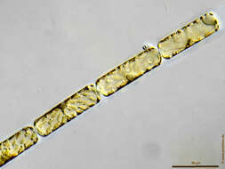
Dactyliosolen fragilissimus Scale bar indicates 50 µm. The specimen was gathered in the Kieler Förde (German Baltic Sea). Sampling date 4/2018. The image was built up using several photomicrographic frames with manual stacking technique. Images were taken using Zeiss Axioplan with Olympus OM-D M5 MKII. Image under Creative Commons License V 3.0 (CC BY-NC-SA). Place name: Baltic Sea, Kieler Förde, Kiel Fjord (Germany) Latitude: 54.3894126 Longitude: 10.1749055 Multiebenen-Abbildung, manuell gestapelt. Der Messbalken markiert eine Länge von 50 µm. Probe aus der Kieler Förde. Datum der Aufsammlung: 4/2018. Mikrotechnik: Zeiss Axioplan, Kamera: Olympus OM-D M5 MKII. Creative Commons License V 3.0 (CC BY-NC-SA).. For permission to use of (high-resolution) images please contact postmaster@protisten.de.
-
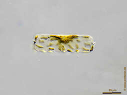
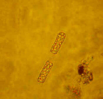
Dactyliosolen fragilissimus Scale bar indicates 25 µm. The specimen was gathered in the Kieler Förde (German Baltic Sea). Sampling date 4/2018. The image was built up using several photomicrographic frames with manual stacking technique. Images were taken using Zeiss Axioplan with Olympus OM-D M5 MKII. Image under Creative Commons License V 3.0 (CC BY-NC-SA). Place name: Baltic Sea, Kieler Förde, Kiel Fjord (Germany) Latitude: 54.3894126 Longitude: 10.1749055 Multiebenen-Abbildung, manuell gestapelt. Der Messbalken markiert eine Länge von 25 µm. Probe aus der Kieler Förde. Datum der Aufsammlung: 4/2018. Mikrotechnik: Zeiss Axioplan, Kamera: Olympus OM-D M5 MKII. Creative Commons License V 3.0 (CC BY-NC-SA).. For permission to use of (high-resolution) images please contact postmaster@protisten.de.
-
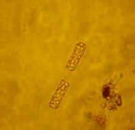
Dactyliosolen fragilissimus Scale bar indicates 50 µm. The specimen was gathered in the Kieler Förde (German Baltic Sea). Sampling date 4/2018. The image was built up using several photomicrographic frames with manual stacking technique. Images were taken using Zeiss Axioplan with Olympus OM-D M5 MKII. Image under Creative Commons License V 3.0 (CC BY-NC-SA). Place name: Baltic Sea, Kieler Förde, Kiel Fjord (Germany) Latitude: 54.3894126 Longitude: 10.1749055 Multiebenen-Abbildung, manuell gestapelt. Der Messbalken markiert eine Länge von 50 µm. Probe aus der Kieler Förde. Datum der Aufsammlung: 4/2018. Mikrotechnik: Zeiss Axioplan, Kamera: Olympus OM-D M5 MKII. Creative Commons License V 3.0 (CC BY-NC-SA).. For permission to use of (high-resolution) images please contact postmaster@protisten.de.