-
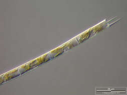
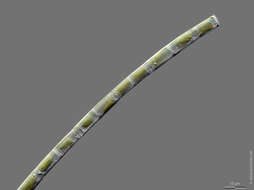
Aulacoseira granulata Scale bar indicates 25 µm. The specimen was gathered in the wetlands of national park Unteres Odertal (100 km north east of Berlin). The image was built up using several photomicrographic frames with manual stacking technique. Images were taken using Zeiss Universal with Olympus C7070 CCD camera. Image under Creative Commons License V 3.0 (CC BY-NC-SA). Place name: Creek in Oder valley 100 km north east of Berlin (Germany) Latitude: 53.135032 Longitude: 14.348738 Multiebenen-Abbildung, manuell gestapelt. Der Messbalken markiert eine Länge von 25 µm. Die Probe wurde in den Feuchtgebieten des Nationalpark Unteres Odertal (100 km nordöstlich von Berlin) gesammelt. Mikrotechnik: Zeiss Universal, Kamera: Olympus C7070. Creative Commons License V 3.0 (CC BY-NC-SA). For permission to use of (high-resolution) images please contact postmaster@protisten.de.
-
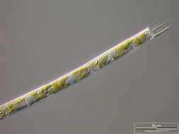
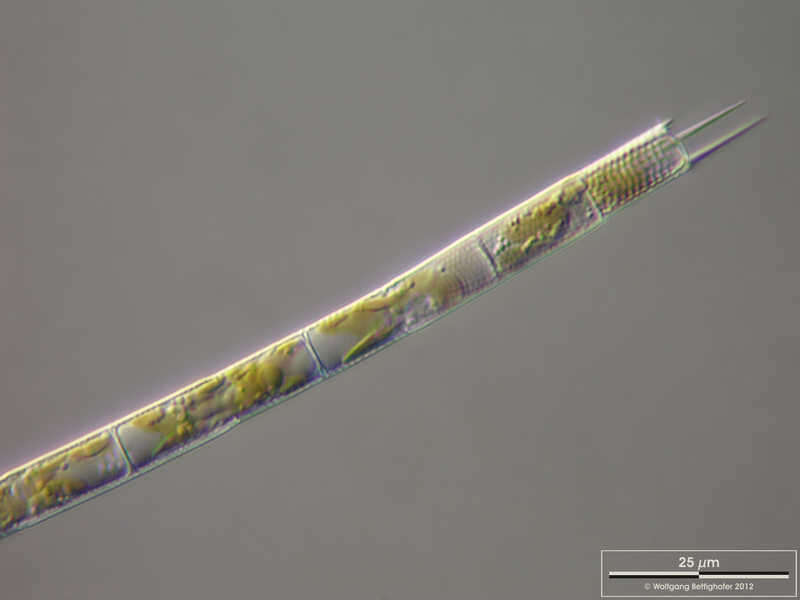
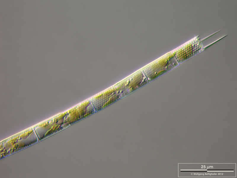
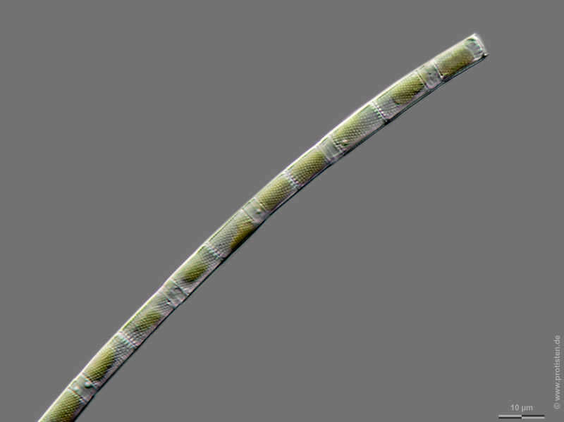
Aulacoseira spec. Scale bar indicates 10 µm. Sample from the Lake Vollstedter See near Kiel, Germany. Sampling date 9/2019. The image was built up using several photomicrographic frames with manual stacking technique. Images were taken using Zeiss Axioplan with Olympus OM-D M5 MKII. Image under Creative Commons License V 3.0 (CC BY-NC-SA). Place name: Lake Vollstedter See near Kiel (Germany) Latitude: 54.24105528 Longitude: 9.859339 Multiebenen-Abbildung, manuell gestapelt. Der Messbalken markiert eine Länge von 10 µm. Probe aus dem Vollstedter See bei Groß Vollstedt. Datum der Aufsammlung: 9/2019. Mikrotechnik: Zeiss Axioplan, Kamera: Olympus OM-D M5 MKII. Creative Commons License V 3.0 (CC BY-NC-SA). For permission to use of (high-resolution) images please contact postmaster@protisten.de.