-
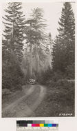
Hiked in from the 76.
-
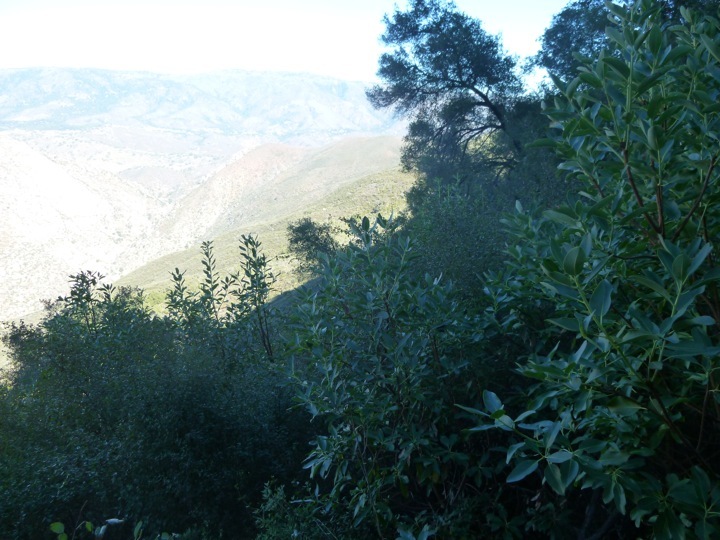
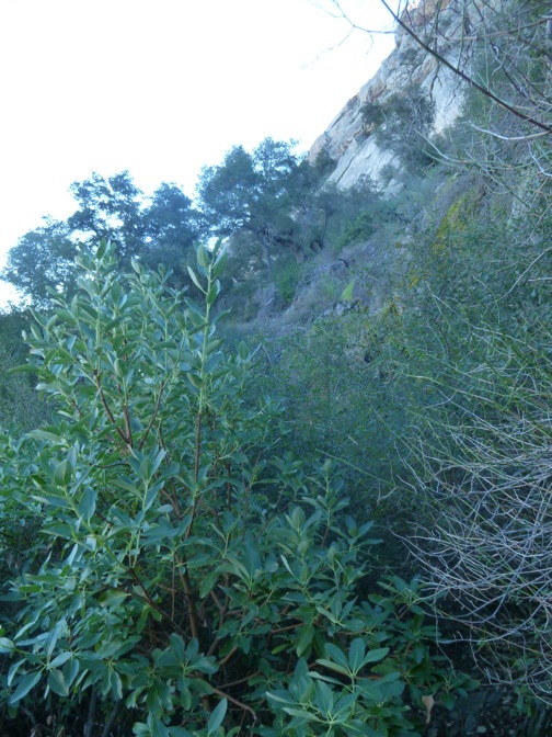
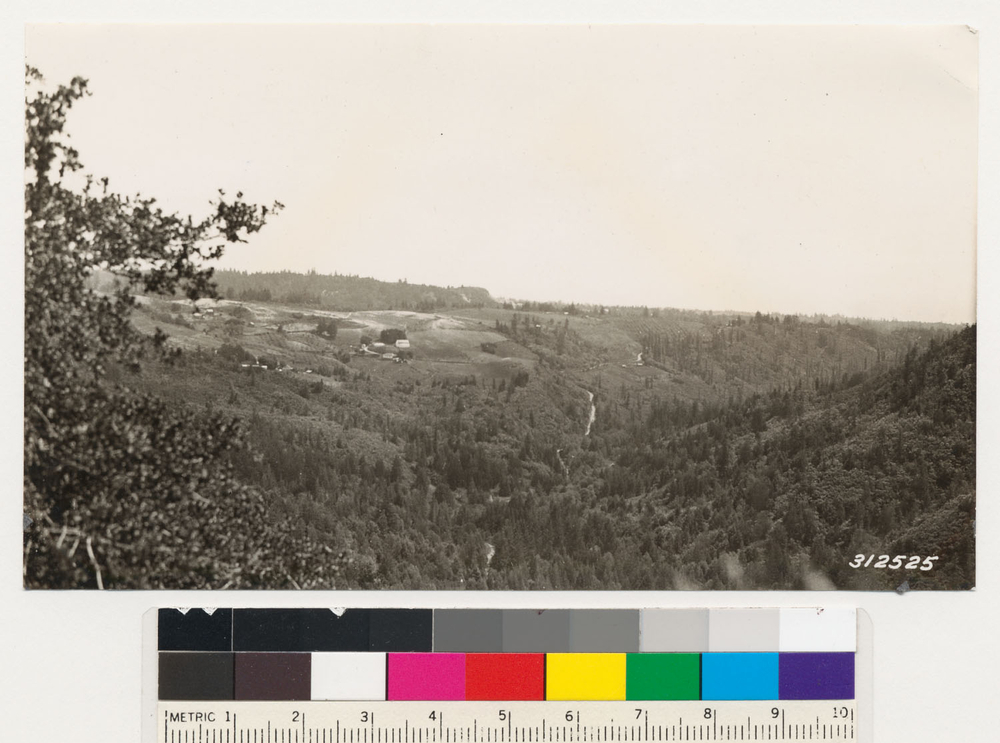
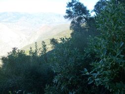
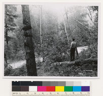
Hiked in from the 76. Photo showing the upper Agua Tibia 'bowl'. Madrones here and there throughout bottom of bowl.
-
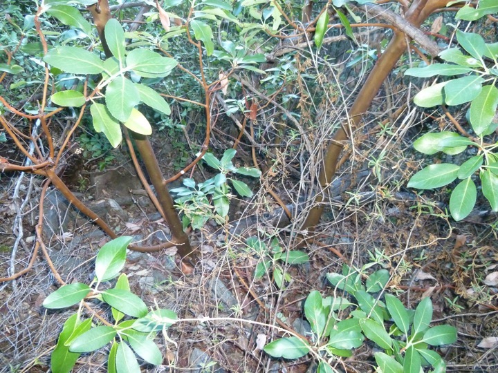
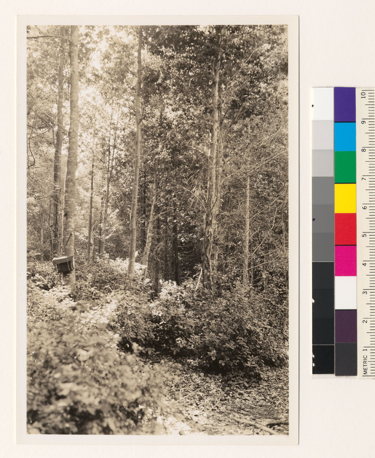
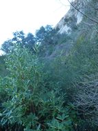
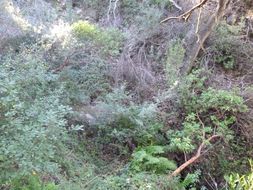
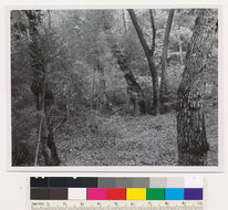
Hiked in from the 76. This individual Madrone is in the bottom of the bowl by the west side creek(there's also an east side creek in the upper Agua Tibia bowl), photo direction is showing northward.
-
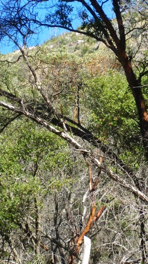
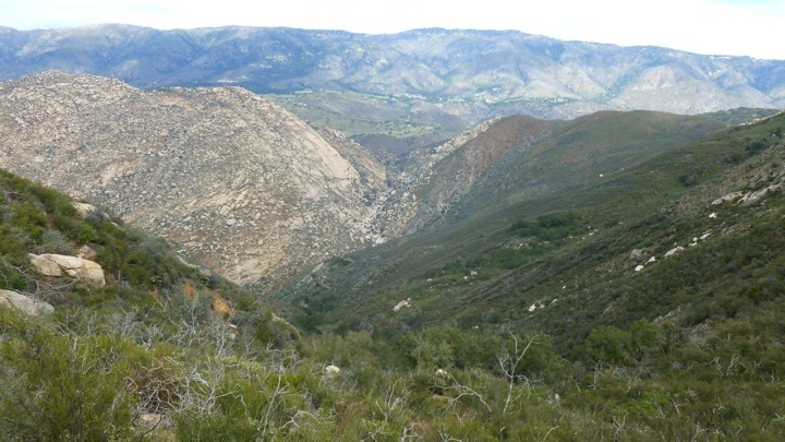
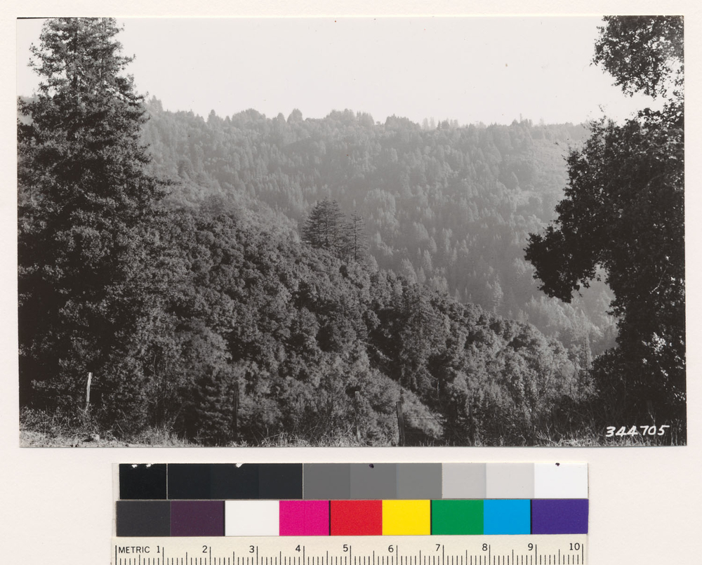
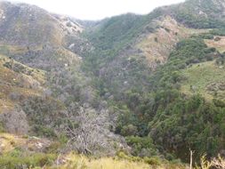
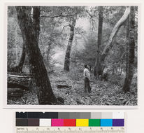
Below the middle 'V' of the magnificent Rodriguez Mtn. escarpment, at the base of the escarpment cliffs. Approach was from Hell Hole Canyon Preserve. Photo view looking out to Palomar Mtn. and La Jolla Indian Reservation in mid-ground. Upper San Luis Rey River is in the bottom ravine. About eight burl-sprouting clumps(due to fire in 2007) of Madrone are in this population patch, about 8 to 10 feet tall from ground level, with multiple shoots per burl. There is no trail to get here, it's a very gnarly access.
-
Below the middle 'V' of the magnificent Rodriguez Mtn. escarpment, at the base of the escarpment cliffs. Approach was from Hell Hole Canyon Preserve. Photo view looking up escarpment, southeast direction. About eight burl-sprouting clumps(due to fire in 2007) of Madrone are in this population patch, about 8 to 10 feet tall from ground level, with multiple shoots per burl. There is no trail to get here, it's a very gnarly access.
-
Below the middle 'V' of the magnificent Rodriguez Mtn. escarpment, at the base of the escarpment cliffs. Approach was from Hell Hole Canyon Preserve. Photo view looking up escarpment, south east direction. About eight burl-sprouting clumps(due to fire in 2007) of Madrone are in this population patch, about 8 to 10 feet tall from ground level, with multiple shoots per burl. There is no trail to get here, it's a very gnarly access.
-
Below the middle 'V' of the magnificent Rodriguez Mtn. escarpment, at the base of the escarpment cliffs. Approach was from Hell Hole Canyon Preserve. Photo showing three burl sprouts(one barely noticeable behind twiggery) of a few years old. About eight burl-sprouting clumps(due to fire in 2007) of Madrone are in this population patch, about 8 to 10 feet tall from ground level, with multiple shoots per burl. There is no trail to get here, it's a very gnarly access.
-
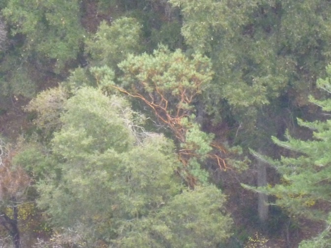
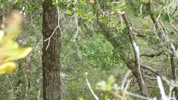
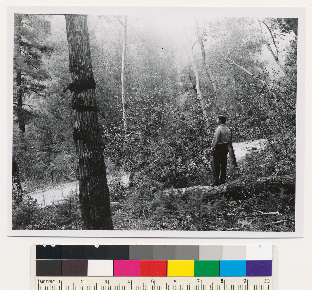
In ravine north side of Rodriguez Mtn, about a 1/4 mile up from flume above San Luis Rey River. Madrone shown here is about 40' tall, with multiple trunks which are probably burl sprouts from decades ago after a fire. Approached from Hell Hole Canyon Preserve, very gnarly hike.
-
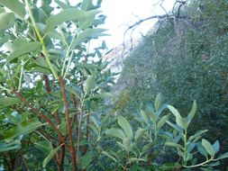
In ravine north side of Rodriguez Mtn, about a 1/4 mile up from flume above San Luis Rey River. Two Madrones shown here are about 12'-15' tall, and possibly 'virgin', - not burl re-sprouters. These two are less than 80 feet up-ravine of the 40' Madrone shown in the previous photo. Approached from Hell Hole Canyon Preserve, very gnarly hike.
-
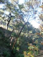
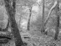
In ravine north side of Rodriguez Mtn, showing the upper-most of the ravine madrones just a little ways down from the saddle from the Hell Hole Canyon approach, and down slope a bit, maybe 60 feet, from a small grove of medium size live oaks. Estimated height of Madrone from soil level is 15'.
-
In ravine north side of Rodriguez Mtn, showing the approach to the upper-most of the ravine madrones just a little ways down from the saddle from the Hell Hole Canyon approach. The upper most of the ravine madrones is about 60 feet down-ravine of the patch of live oaks in the lower portion of this photo, which is about a 100 yards away from where the camera position is.
-
2005 The Regents of the University of California
CalPhotos
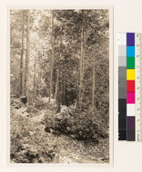
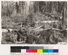
Tan oak stand about 30 years old, thinned in 1932. Redwood, madrone, nearby associates. Note vigorous sprouting of tan oak from stumps after thinning on N. H. Ormsbee property in Hinckley creek. Site index 200+. Hinckley Basin., T 10 S R 1 W Sec 13, Elevation 700 Quad name: New Almaden. Quad number: 85C. Reference to map: 12.
-
2005 The Regents of the University of California
CalPhotos
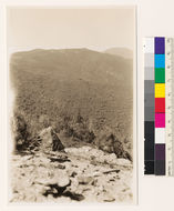
Looking west along Loma Prieta Ridge. Chamise chaparral and chaparral on ridges in foreground. Main chaparral species are Pickeringia montana, Arctostaphylos glandulosa, Quercus wislizeni, Ceanothus papillosus, Arbutus menziesii and Notholithocarpus densiflorus (=Notholithocarpus densiflorus (=Lithocarpus densiflora)) are main woodland species in drains in foreground. Note stringers of redwood in gulch in middle distance. Loma Prieta Mt., on extreme right skyline., T 10 S R 2 E Sec 18, Elevation 2000-3800 Quad name: New Almaden. Quad number: 85C. Reference to map: 10.
-
2005 The Regents of the University of California
CalPhotos
Douglas fir, tanbark oak and madrone standing outside of burn., T 10 S R 2 W Sec 7 Quad name: Santa Cruz. Quad number: 84. Reference to map: 105.
-
2005 The Regents of the University of California
CalPhotos
Dougalas fir type on Camp Creek, east slope. Hardwood associates: Notholithocarpus densiflorus (=Notholithocarpus densiflorus (=Lithocarpus densiflora)), Arbutus menziesii, Chrysolepischrysophylla var. chrysophylla (=Castanopsis chrysophylla)., T 11 N R 5 E Sec 25 Quad name: Hoopa. Quad number: 11.
-
2005 The Regents of the University of California
CalPhotos
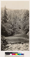
Looking east across Quercus agrifolia type to redwood, tan oak, madrone mixture of second growth 40-60 years old., T 11 S R 2 E Sec 2, Elevation 1500 Quad name: Morgan Hill. Quad number: 85D. Reference to map: 10.
-
2005 The Regents of the University of California
CalPhotos
By road approx. 3.5 miles north of Somes Bar. Tan oak Madrone type with some small Douglas fir reproduction. Potential Douglas fir types. Site 150 to 175. DBH of hardwoods from 6" to 14". Assoc. sp.: Occasional Umbellularia californica. Siskiyou County, T 12 N R 6 E Sec 16 Quad name: Orleans. Quad number: 11A1.
-
2005 The Regents of the University of California
CalPhotos
By road approx. 4 miles north of Somes Bar. Tan oak Madrone type with abundant Douglas fir reproduction. Potential Douglas fir type- site 175. DBH of hardwood tress from 12" to 18". Tan oaks in foreground, madrones in rear. Assoc. sp.: Umbellularia californica., T 12 N R 6 E Sec 16 Quad name: Orleans. Quad number: 11A1.
-
2005 The Regents of the University of California
CalPhotos
By hwy. approx 20 miles south of Happy Camp. Tan oak, Madrone type with no stocking of large Douglas fir trees except some of reproduction. Douglas fir potential type - site 175. WLC looking at approx. 17 " Tan oak. Madrones and Tan oaks in picture from 14" to 26" dbh. Assoc. sp.: Umbellularia californica scattered throughout stand., T 14 N R 6 E Sec 16 Quad name: Dillon Mtn.. Quad number: 8.
-
2005 The Regents of the University of California
CalPhotos
By highway approx. 20 mile south of Happy Camp. Tan oak -Madrone type with no stocking of large Douglas fir trees except some DF reproduction. Douglas fir potential type. Site 175. Tanoak and madrone in picture from 14" to 26" dbh. Umbellularia californica scattered throughout stand., T 14 N R 6 E Sec 16 Quad name: Dillon Mtn.. Quad number: 8.
-
2005 The Regents of the University of California
CalPhotos
Sugar pine, Redwood, Douglas fir type. Large redwood in center is 107" D.B.H. and 150' high. Mature height of sugar pine is 143 feet. Understory of Notholithocarpus densiflorus (=Notholithocarpus densiflorus (=Lithocarpus densiflora)), Chrysolepischrysophylla var. chrysophylla (=Castanopsis chrysophylla), Arbutus menziesii, Ceanothus velutinus,Rhododendron macrophyllum (=Rhododendron californicum), Vaccinium ovatum, Gaultheria shallon and Arctostaphylos nevadensis., T 17 N R 2 E Sec 35 Quad name: Preston Peak. Quad number: 8. Reference to map: 4.
-
2005 The Regents of the University of California
CalPhotos
Succession of second growth Ponderosa pine to Timberland Chaparral (Arctostaphylos viscida, Chamaebatia foliolosa, Arbutus menziesii, and miscellaneous herbaceous spp. following fire. Site Index 175. On ridge between Grizzly Creek and Middle Fork Yuba River., T 18 N R 8 E Sec 13 Quad name: Smartsville. Quad number: 50. Reference to map: 44.
-
2005 The Regents of the University of California
CalPhotos
Near Bullards Bar Road. Association of Ponderosa pine and Madrone. Ground cover of Chamaebatia foliolosa., T 18 N R 8 E Sec 30 Quad name: Smartsville. Quad number: 50. Reference to map: 57.