-
-
-
-
-
-
-
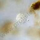
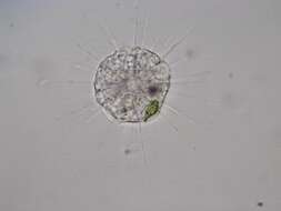
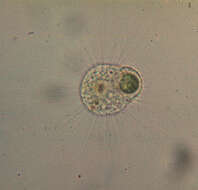
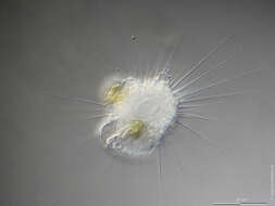
Longitude (deg): -0.1. Latitude (deg): 50.8. Longitude (deg/min): 0° 10' W. Latitude (deg/min): 50° 50' N. Vice county name: East Sussex. Vice county no.: 14. Country: England. Identified by: Malcolm Storey. Category: standard photograph or close-up. Photographic equipment used: "35mm transparencies (on a variety of films, but Agfa CT18 in the 1960's to early 1980's followed by Fujichrome in the late 1980's.) Transparencies scanned with Minolta Dimage Scan Dual II AF-2820U transparency scanner.".
-
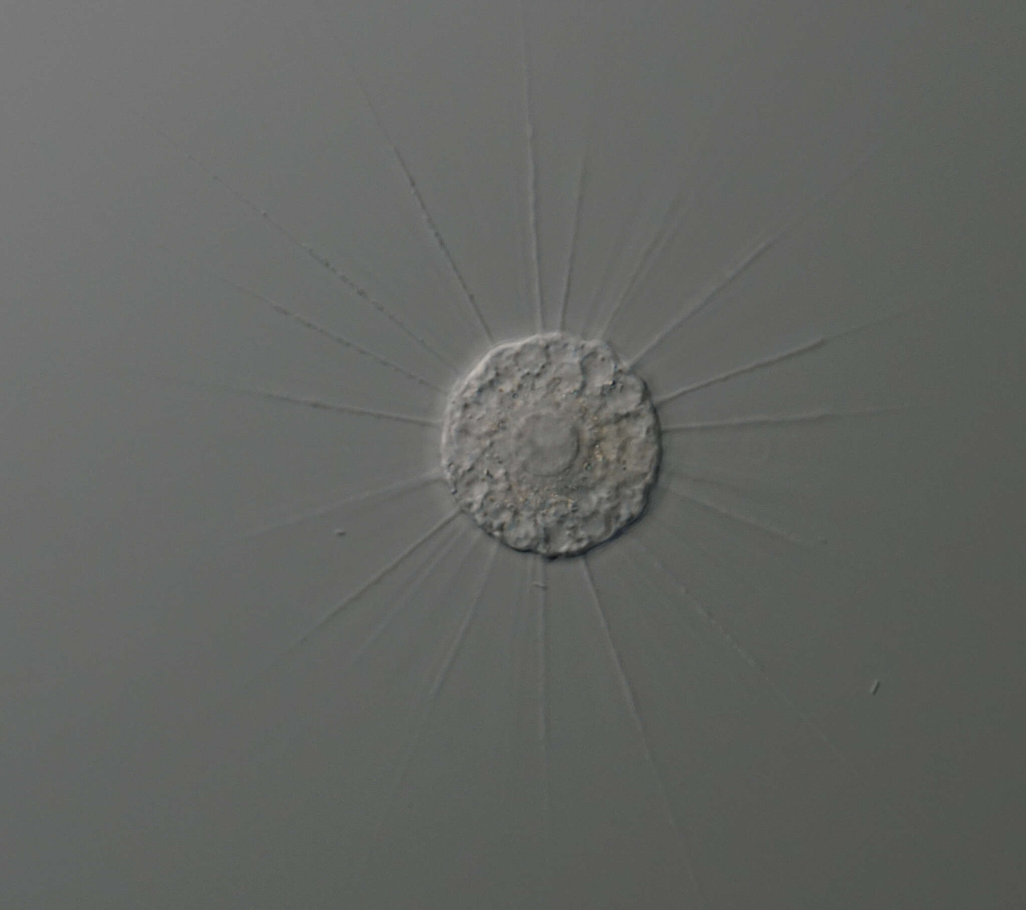
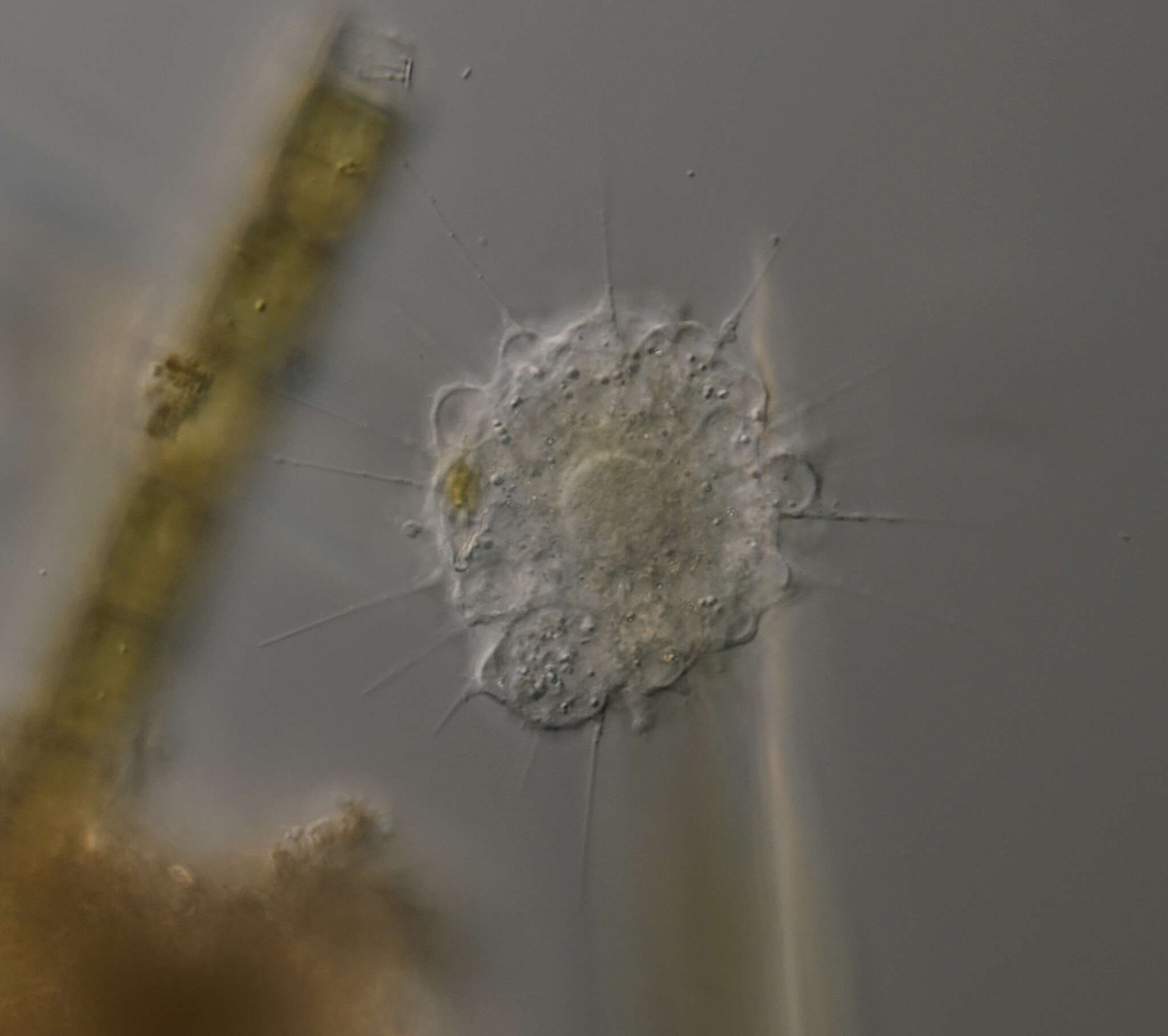
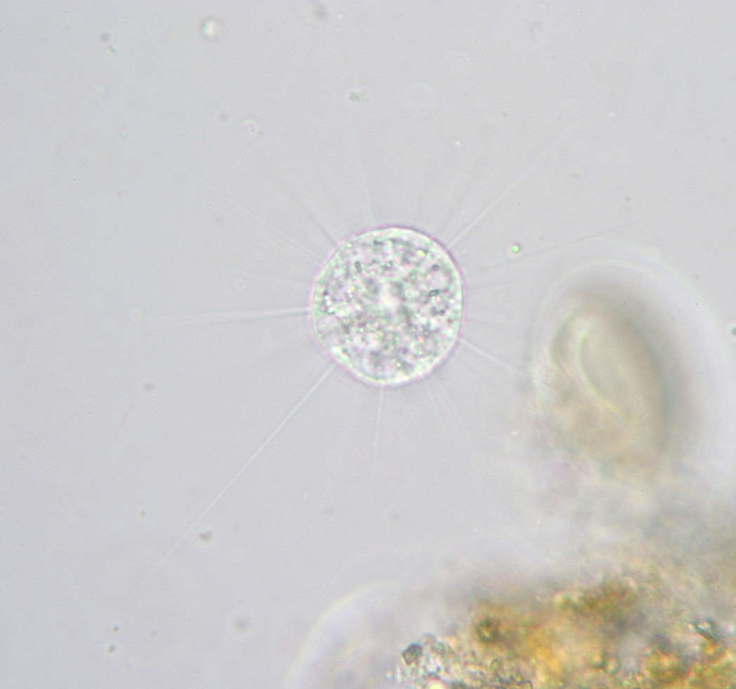
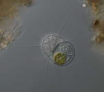
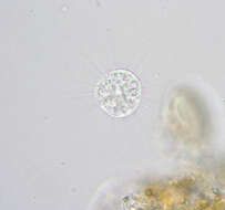
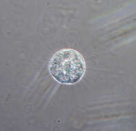
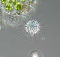
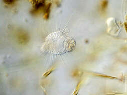
Longitude (deg): -2.1. Latitude (deg): 54.0. Longitude (deg/min): 2° 10' W. Latitude (deg/min): 54° 10' N. Vice county name: Mid-west Yorks. Vice county no.: 64. Country: England. Identified by: Malcolm Storey. Comment: in sample from tarn outfall. Category: microscope photograph. Image scaling: magnified. Photographic equipment used: Canon EOS10D dSLR and Meiji microscope with x2.5 projection eye-piece. DPI defaulting to 72.
-
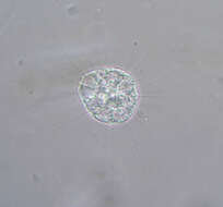
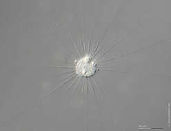
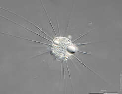
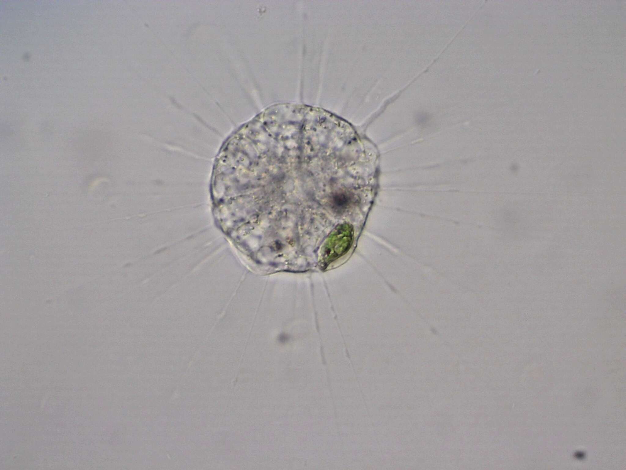
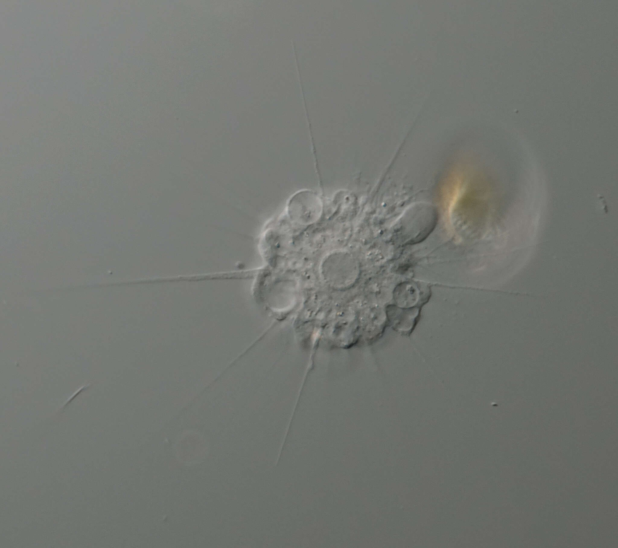
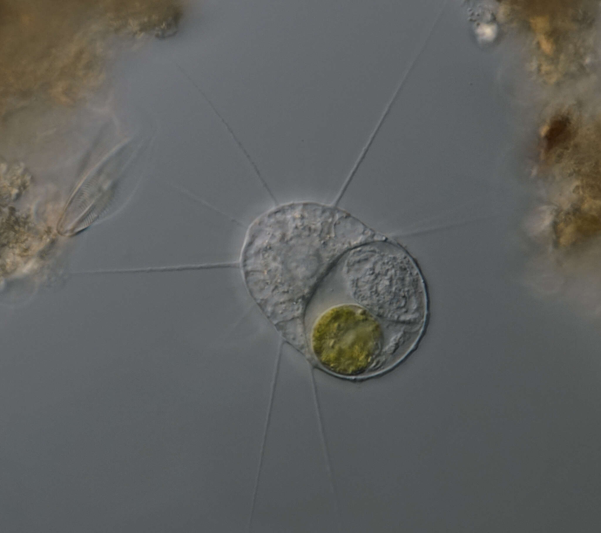
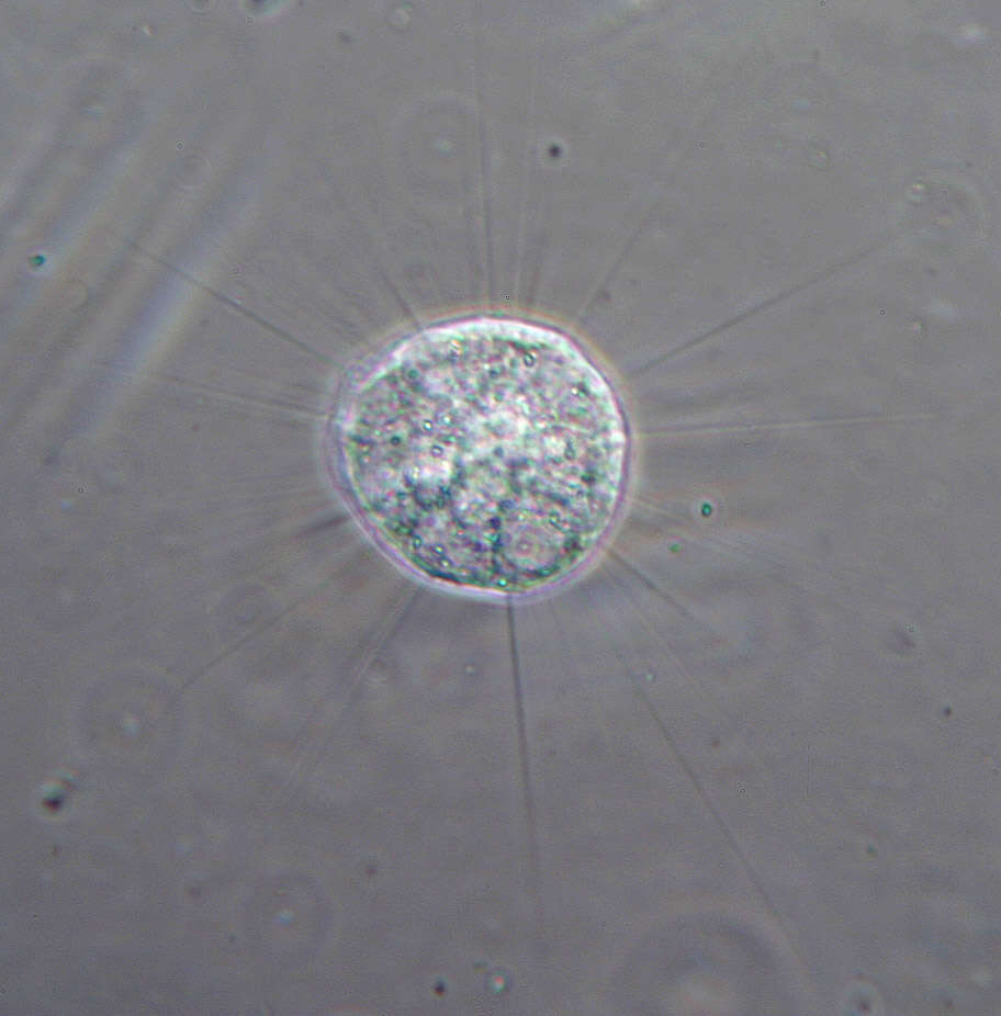
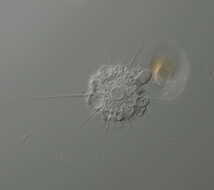
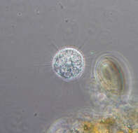
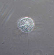
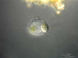
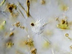
Longitude (deg): -2.4. Latitude (deg): 53.5. Longitude (deg/min): 2° 20' W. Latitude (deg/min): 53° 30' N. Vice county name: South Lancs. Vice county no.: 59. Country: England. Identified by: Malcolm Storey. Comment: In Vaucheria sample cultured in tap water. Category: microscope photograph. Image scaling: magnified. Photographic equipment used: Canon EOS10D dSLR and Meiji microscope with x2.5 projection eye-piece. DPI defaulting to 72.
-
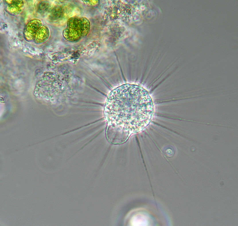
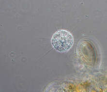
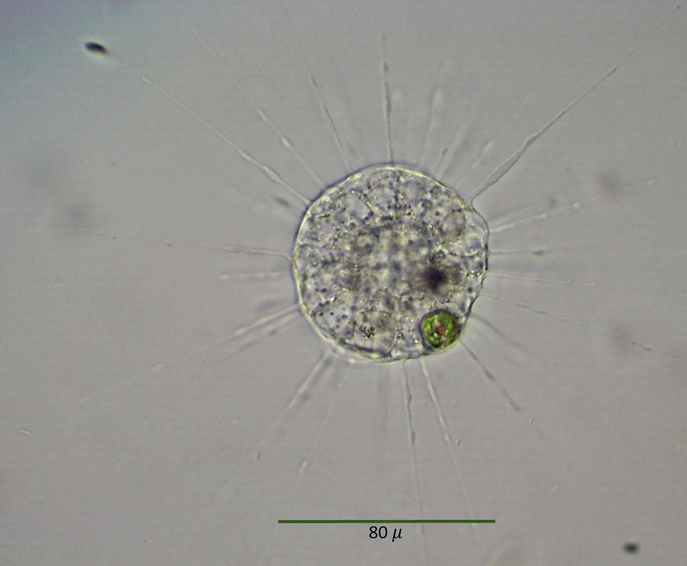
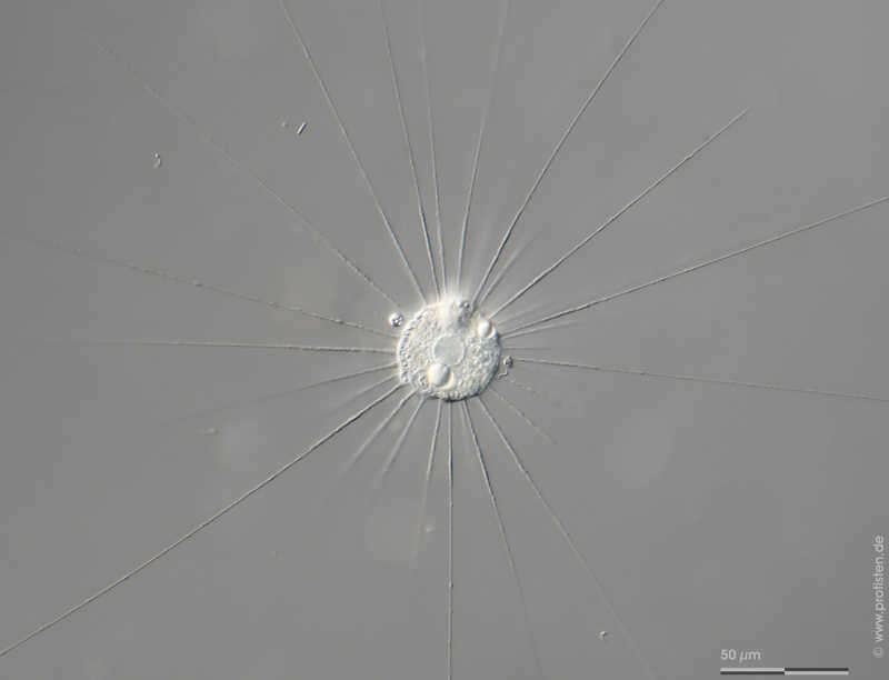
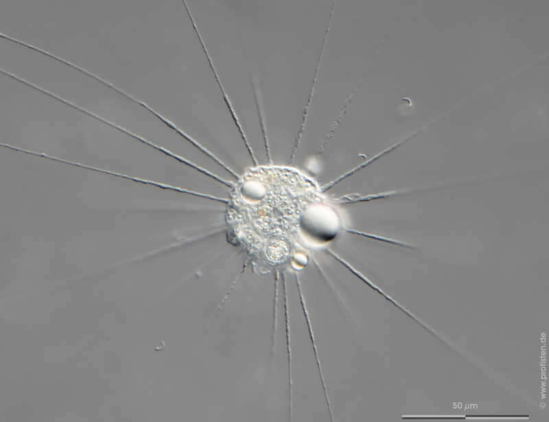
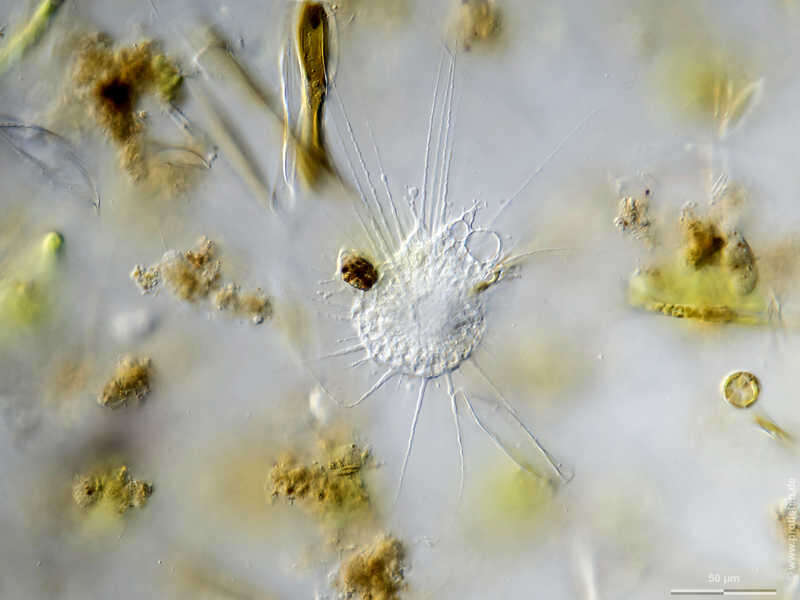
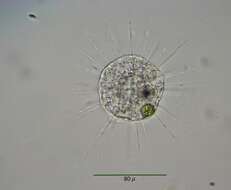
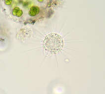
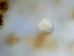
Actinophrys sol Scale bar indicates 50 µm. Collected from on a pond near the Bodden bay Schwarzer Peter in the southern part of the isle Hiddensee (German Baltic Sea). The image was built up using several photomicrographic frames with manual stacking technique. Images were taken using Zeiss Axioplan with Olympus OM-D M5 MKII.Image under Creative Commons License V 3.0 (CC BY-NC-SA). Place name: Hiddensee Bodden (Germany) Latitude: 54.582633 Longitude: 13.115051 Multiebenen-Abbildung, manuell gestapelt. Der Messbalken markiert eine Länge von 50 µm. Probe aus eine Teich nahe der Boddenbucht Schwarzer Peter im Süden von Hiddensee. Mikrotechnik: Zeiss Axioplan, Kamera: Olympus O-D M5 MKII. Creative Commons License V 3.0 (CC BY-NC-SA). For permission to use of (high-resolution) images please contact postmaster@protisten.de.
-
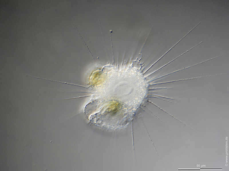
Actinophrys sol Series (frame 4) of contracting vacuole. Scale bar indicates 50 µm. Collected from on a pond near the Bodden bay Schwarzer Peter in the southern part of the isle Hiddensee (German Baltic Sea). The image was built up using several photomicrographic frames with manual stacking technique. Images were taken using Zeiss Axioplan with Olympus OM-D M5 MKII.Image under Creative Commons License V 3.0 (CC BY-NC-SA). Place name: Hiddensee Bodden (Germany) Latitude: 54.582633 Longitude: 13.115051 Serie (4. Bild) zur kontraktilen Vakuole. Multiebenen-Abbildung, manuell gestapelt. Der Messbalken markiert eine Länge von 50 µm. Probe aus eine Teich nahe der Boddenbucht Schwarzer Peter im Süden von Hiddensee. Mikrotechnik: Zeiss Axioplan, Kamera: Olympus O-D M5 MKII. Creative Commons License V 3.0 (CC BY-NC-SA). For permission to use of (high-resolution) images please contact postmaster@protisten.de.
-
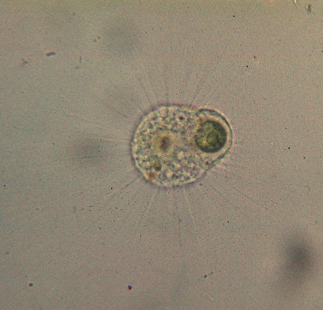
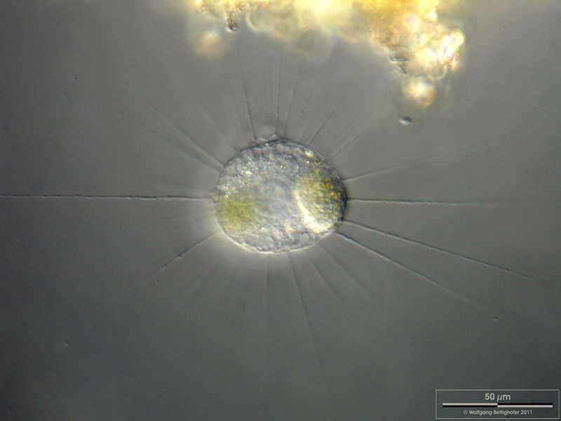
Actinophrys sol Focus on nucleus in the center of the cell. Scale bar indicates 50 µm. Sample from a pond situated in the vicinity of Lake Constance. The image was built up using several photomicrographic frames with manual stacking technique. Images were taken using Zeiss Universal with Olympus C7070 CCD camera.Image under Creative Commons License V 3.0 (CC BY-NC-SA). Place name: Pond situated in the vicinity of Lake Constance (Germany) Latitude: 47.734945 Longitude: 9.091097 Fokuseben auf dem Zellkern, der in der Zellmitte liegt. Multiebenen-Abbildung, manuell gestapelt. Der Messbalken markiert eine Länge von 50 µm. Probe aus einem Teich in der Nähe des Bodensees. Mikrotechnik: Zeiss Universal, Kamera: Olympus C7070. Creative Commons License V 3.0 (CC BY-NC-SA). For permission to use of (high-resolution) images please contact postmaster@protisten.de.
-
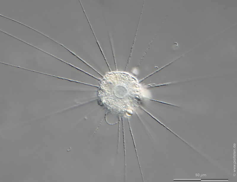
Actinophrys sol Scale bar indicates 50 µm. Collected from Bodden, the brackish water between the isles of Hiddensee an Ruegen (German Baltic Sea). The image was built up using several photomicrographic frames with manual stacking technique. Images were taken using Zeiss Universal with Olympus OM-D M5 MKII.Image under Creative Commons License V 3.0 (CC BY-NC-SA). Place name: Preflooder south of the village Kloster, Hiddensee (German Baltic Sea) Latitude: 54.57611642 Longitude: 13.11450005 Multiebenen-Abbildung, manuell gestapelt. Der Messbalken markiert eine Länge von 50 µm. Probe aus dem Bodden (Brackwasser) vor Hiddensee. Mikrotechnik: Zeiss Universal, Kamera: Olympus O-D M5 MKII. Creative Commons License V 3.0 (CC BY-NC-SA). For permission to use of (high-resolution) images please contact postmaster@protisten.de.
-
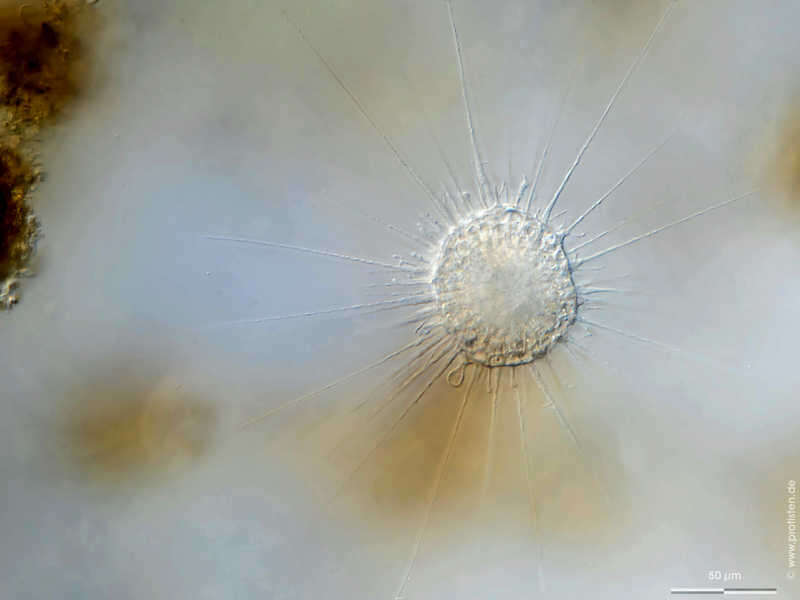
Actinophrys sol Scale bar indicates 50 µm. Collected from on a pond near the Bodden bay Schwarzer Peter in the southern part of the isle Hiddensee (German Baltic Sea). The image was built up using several photomicrographic frames with manual stacking technique. Images were taken using Zeiss Axioplan with Olympus OM-D M5 MKII.Image under Creative Commons License V 3.0 (CC BY-NC-SA). Place name: Hiddensee Bodden (Germany) Latitude: 54.582633 Longitude: 13.115051 Multiebenen-Abbildung, manuell gestapelt. Der Messbalken markiert eine Länge von 50 µm. Probe aus eine Teich nahe der Boddenbucht Schwarzer Peter im Süden von Hiddensee. Mikrotechnik: Zeiss Axioplan, Kamera: Olympus O-D M5 MKII. Creative Commons License V 3.0 (CC BY-NC-SA). For permission to use of (high-resolution) images please contact postmaster@protisten.de.
-
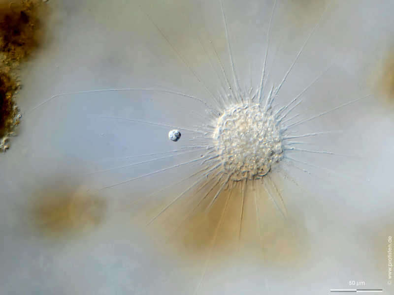
Actinophrys sol Scale bar indicates 50 µm. Collected from Bodden, the brackish water between the isles of Hiddensee an Ruegen (German Baltic Sea). The image was built up using several photomicrographic frames with manual stacking technique. Images were taken using Zeiss Universal with Olympus OM-D M5 MKII.Image under Creative Commons License V 3.0 (CC BY-NC-SA). Place name: Hiddensee Bodden (Germany) Latitude: 54.582633 Longitude: 13.115051 Multiebenen-Abbildung, manuell gestapelt. Der Messbalken markiert eine Länge von 50 µm. Probe aus dem Bodden (Brackwasser) vor Hiddensee. Mikrotechnik: Zeiss Universal, Kamera: Olympus O-D M5 MKII. Creative Commons License V 3.0 (CC BY-NC-SA). For permission to use of (high-resolution) images please contact postmaster@protisten.de.
-
Actinophrys sol Scale bar indicates 50 µm. Collected from Bodden, the brackish water between the isles of Hiddensee an Ruegen (German Baltic Sea). The image was built up using several photomicrographic frames with manual stacking technique. Images were taken using Zeiss Universal with Olympus OM-D M5 MKII.Image under Creative Commons License V 3.0 (CC BY-NC-SA). Place name: Hiddensee Bodden (Germany) Latitude: 54.582633 Longitude: 13.115051 Multiebenen-Abbildung, manuell gestapelt. Der Messbalken markiert eine Länge von 50 µm. Probe aus dem Bodden (Brackwasser) vor Hiddensee. Mikrotechnik: Zeiss Universal, Kamera: Olympus O-D M5 MKII. Creative Commons License V 3.0 (CC BY-NC-SA). For permission to use of (high-resolution) images please contact postmaster@protisten.de.