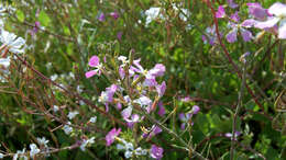
Longitude (deg): -1.0. Latitude (deg): 53.9. Longitude (deg/min): 1° 0' W. Latitude (deg/min): 53° 60' N. Country: England. Stage: Plant. Identified by: Malcolm Storey. Category: standard photograph or close-up. Photographic equipment used: "35mm transparencies (on a variety of films, but Agfa CT18 in the 1960's to early 1980's followed by Fujichrome in the late 1980's.) Transparencies scanned with Minolta Dimage Scan Dual II AF-2820U transparency scanner.".
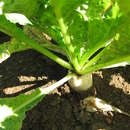
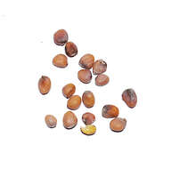
Seed IdentificationCommon name: radishBotanical Name: Raphanus sativusFamily name: CruciferaeLocation: Valley Heights, NSWDate: 21st April 2009Collector: John PoulakisHabitat: An annual growing to up to 0.2m. Prefers to grow in semi-shade (light woodland) or no shade environments and requires moist soil.Economic significance: Grown as a food crop and also for various medicinal uses. The root and the leaves are edible.