-
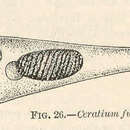
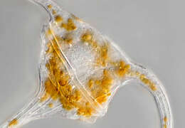
Description: Ceratium furca (Ehr.) Claparède et Lachmann 1858; Ceratiaceae, Gonyaulacales, Dinophyceae, Dinoflagellata (Dinophyta) English: Hydrofront of Dnieper-Bug Liman Русский: Гидрофронт
Днепро-Бугского лимана. Date: 12 December 2007. Source: Own work. Author:
Minami Himemiya.
-
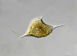
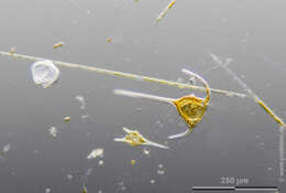
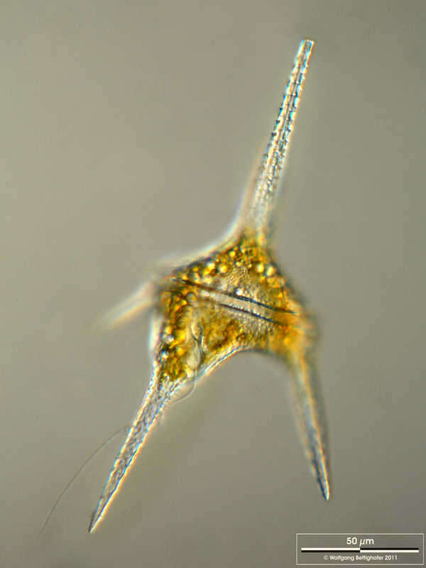
Tripos lineatus Scale bar indicates 50 µm. The specimen was gathered in the Kieler Förde (Baltic Sea). Sampling date 2/2022. The image was built up using several photomicrographic frames with manual stacking technique. Images were taken using Zeiss Axioplan with Olympus OM-D M5 MKII. Image under Creative Commons License V 3.0 (CC BY-NC-SA). Place name: Baltic Sea, Kieler Förde, Kiel Fjord (Germany) Latitude: 54.3894126 Longitude: 10.1749055 Multiebenen-Abbildung, manuell gestapelt. Der Messbalken markiert eine Länge von 50 µm. Probe aus der Kieler Förde. Datum der Aufsammlung: 2/2022. Mikrotechnik: Zeiss Axioplan, Kamera: Olympus OM-D M5 MKII. Creative Commons License V 3.0 (CC BY-NC-SA). For permission to use of (high-resolution) images please contact postmaster@protisten.de.
-
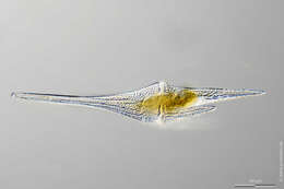
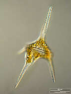
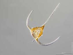
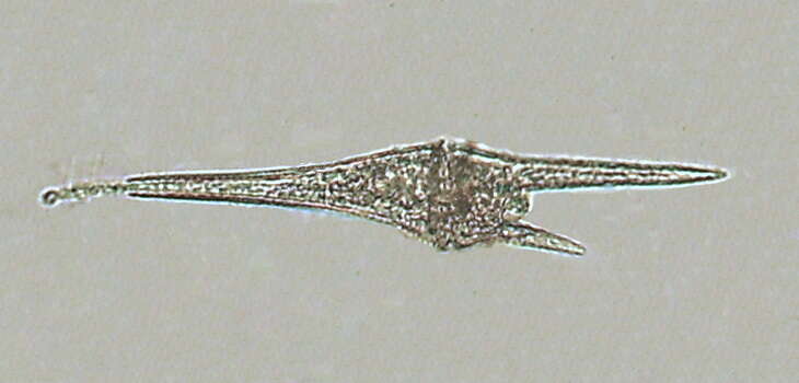
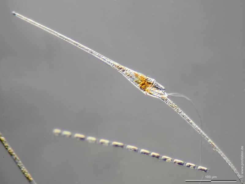
Tripos fusus Synonym: Ceratium fusus.Scale bar indicates 100 µm. The specimen was gathered in the Kieler Förde (German Baltic Sea). Sampling date 3/2018. The image was built up using several photomicrographic frames with manual stacking technique. Images were taken using Zeiss Axioplan with Olympus OM-D M5 MKII. Image under Creative Commons License V 3.0 (CC BY-NC-SA). Place name: North Sea around Heligoland Latitude: 54.186311 Longitude: 7.895034 Synonym: Ceratium fusus.Multiebenen-Abbildung, manuell gestapelt. Der Messbalken markiert eine Länge von 100 µm. Probe aus der Kieler Förde. Datum der Aufsammlung: 3/2018. Mikrotechnik: Zeiss Axioplan, Kamera: Olympus OM-D M5 MKII. Creative Commons License V 3.0 (CC BY-NC-SA). For permission to use of (high-resolution) images please contact postmaster@protisten.de.
-
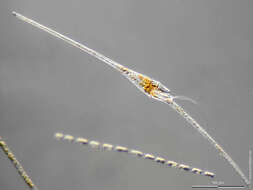
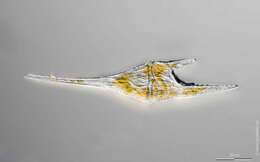
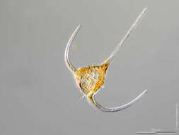
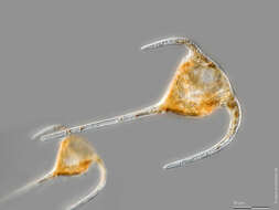
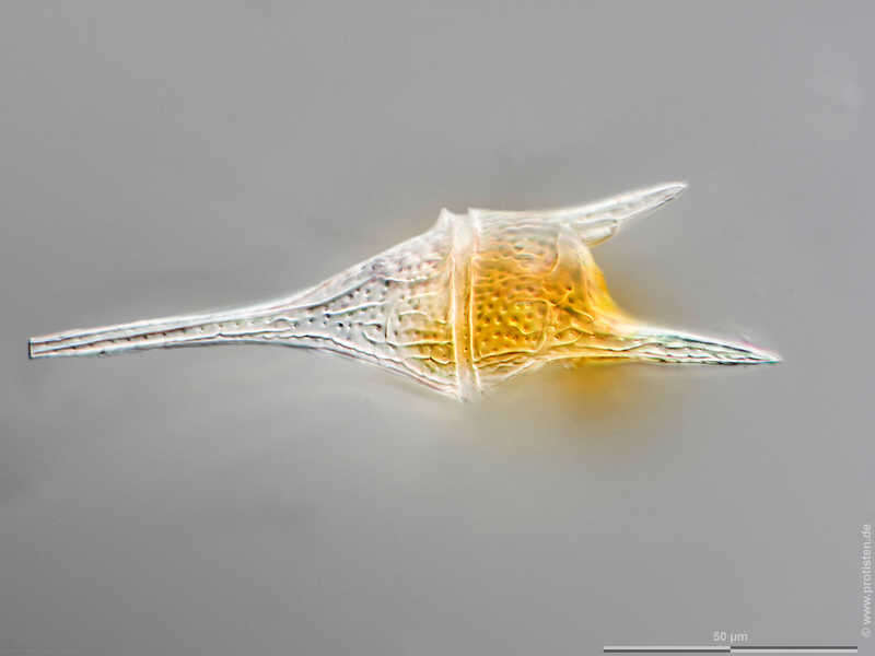
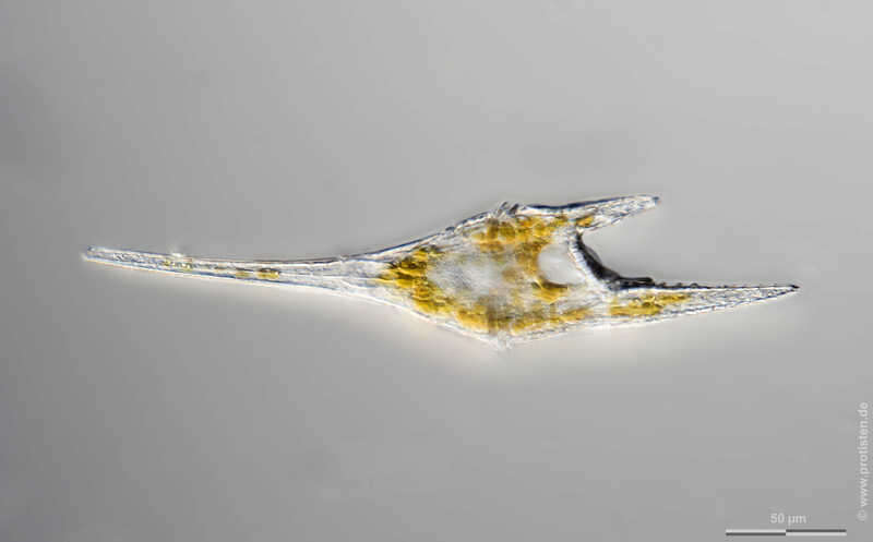
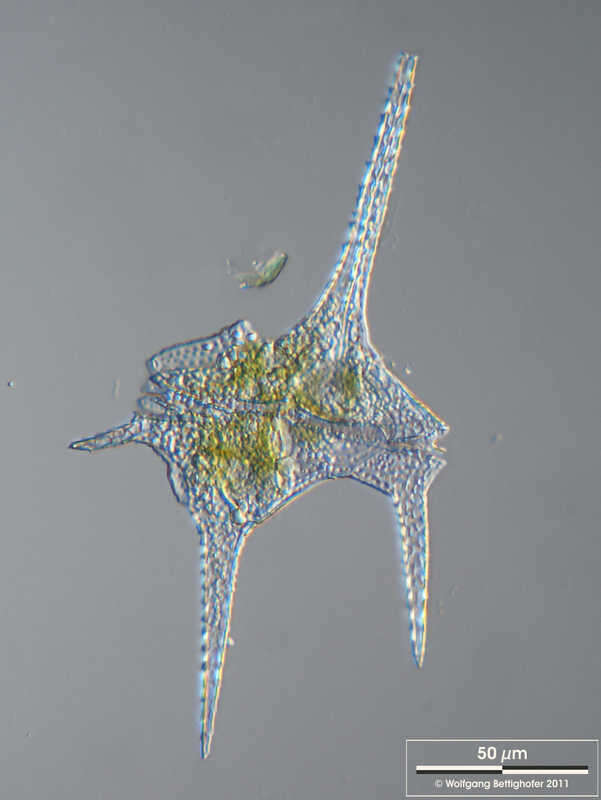
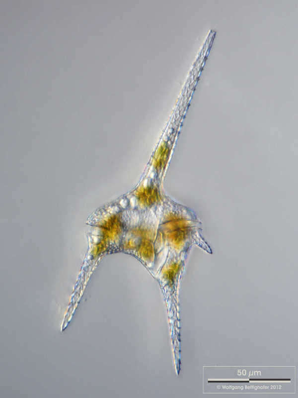
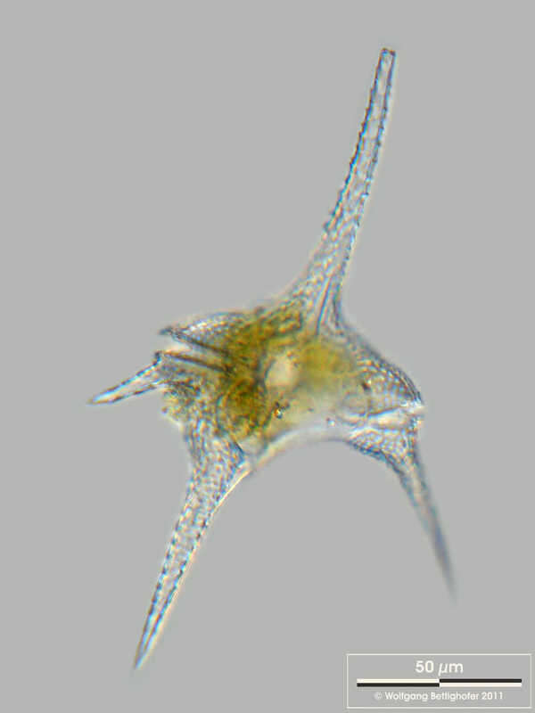
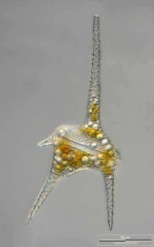
Tripos furca Synonym: Ceratium furca.Sample from North Sea near Heligoland (spring diatom bloom). Scale bar indicates 50 µm. The image was built up using several photomicrographic frames with manual stacking technique. Images were taken using Zeiss Axioplan with MFT camera Olympus OM-D E-M5 II.Image under Creative Commons License V 3.0 (CC BY-NC-SA). Place name: North Sea around Heligoland Latitude: 54.186311 Longitude: 7.895034 Synonym: Ceratium furca.Multiebenen-Abbildung, manuell gestapelt. Der Messbalken markiert eine Länge von 50 µm. Probe aus der Nordsee vor Helgoland. Mikrotechnik: Zeiss Axioplan, Kamera: Olympus OM-D E-M5 II. Creative Commons License V 3.0 (CC BY-NC-SA). For permission to use of (high-resolution) images please contact postmaster@protisten.de.
-
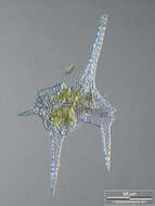
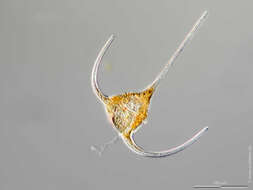
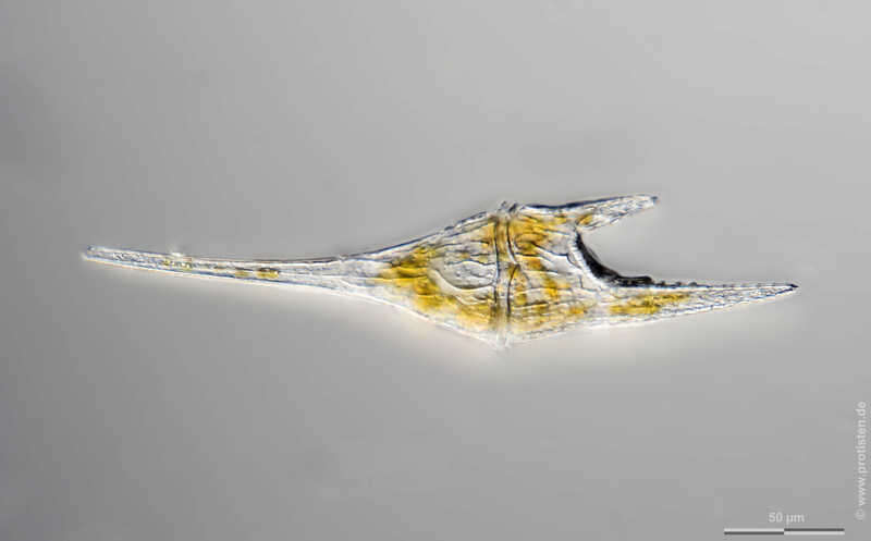
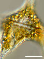
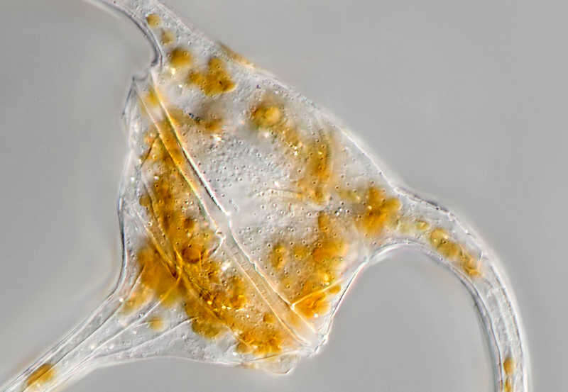
Tripos furca Scale bar indicates 100 µm. The specimen was gathered in the Kieler Förde (Baltic Sea). Sampling date 1/2022. The image was built up using several photomicrographic frames with manual stacking technique. Images were taken using Olympus stereo microscope SZX16/Planapo 2.0x with Olympus OM-D M5 MKII. Image under Creative Commons License V 3.0 (CC BY-NC-SA). Place name: Baltic Sea, Kieler Förde, Kiel Fjord (Germany) Latitude: 54.3894126 Longitude: 10.1749055 Multiebenen-Abbildung, manuell gestapelt. Der Messbalken markiert eine Länge von 100 µm. Probe aus der Kieler Förde. Datum der Aufsammlung: 1/2022. Mikrotechnik: Olympus stereo microscope SZX16/Planapo 2.0x, Kamera: Olympus OM-D M5 MKII. Creative Commons License V 3.0 (CC BY-NC-SA). For permission to use of (high-resolution) images please contact postmaster@protisten.de.
-
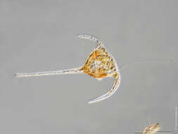
Tripos furca Synonym: Ceratium furca.Sample from North Sea near Heligoland (spring diatom bloom). Scale bar indicates 50 µm. The image was built up using several photomicrographic frames with manual stacking technique. Images were taken using Zeiss Axioplan with MFT camera Olympus OM-D E-M5 II.Image under Creative Commons License V 3.0 (CC BY-NC-SA). Place name: North Sea around Heligoland Latitude: 54.186311 Longitude: 7.895034 Synonym: Ceratium furca.Multiebenen-Abbildung, manuell gestapelt. Der Messbalken markiert eine Länge von 50 µm. Probe aus der Nordsee vor Helgoland. Mikrotechnik: Zeiss Axioplan, Kamera: Olympus OM-D E-M5 II. Creative Commons License V 3.0 (CC BY-NC-SA). For permission to use of (high-resolution) images please contact postmaster@protisten.de.
-
Ceratium hirundinella Transverse groove is shown, which contains the transverse flagellum. One can also see a part of the longitudinal groove and the whole longitudinal flagellum. Scale bar indicates 50 µm. Sample from the Lake Constance (vicinity of Bodman). The image was built up using several photomicrographic frames with manual stacking technique. Images were taken using Zeiss Universal with Olympus C7070 CCD camera.Image under Creative Commons License V 3.0 (CC BY-NC-SA). Place name: Lake Constance vicinity of Bodman (Germany) Latitude: 47.796494 Longitude: 9.047656 Darstellung der Querfurche, in welcher die Quergeißel liegt, sowie der Längsfurche mit Längsgeißel. Multiebenen-Abbildung, manuell gestapelt. Der Messbalken markiert eine Länge von 50 µm. Probe aus dem Bodensee in der Nähe von Bodman. Mikrotechnik: Zeiss Universal, Kamera: Olympus C7070. Creative Commons License V 3.0 (CC BY-NC-SA). For permission to use of (high-resolution) images please contact postmaster@protisten.de.
-
Ceratium hirundinella Scale bar indicates 50 µm. Sample from the Lake Constance (vicinity of Bodman). The image was built up using several photomicrographic frames with manual stacking technique. Images were taken using Zeiss Universal with Olympus C7070 CCD camera.Image under Creative Commons License V 3.0 (CC BY-NC-SA). Place name: Lake Constance vicinity of Bodman (Germany) Latitude: 47.796494 Longitude: 9.047656 Multiebenen-Abbildung, manuell gestapelt. Der Messbalken markiert eine Länge von 50 µm. Probe aus dem Bodensee in der Nähe von Bodman. Mikrotechnik: Zeiss Universal, Kamera: Olympus C7070. Creative Commons License V 3.0 (CC BY-NC-SA). For permission to use of (high-resolution) images please contact postmaster@protisten.de.
-
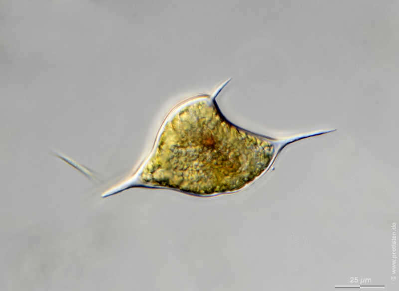
Ceratium hirundinella Zoom-in with nucleus, part of the longitudinal groove and flagellum. Scale bar indicates 25 µm. Sample from the Lake Constance (vicinity of Bodman). The image was built up using several photomicrographic frames with manual stacking technique. Images were taken using Zeiss Universal with Olympus C7070 CCD camera.Image under Creative Commons License V 3.0 (CC BY-NC-SA). Place name: Lake Constance vicinity of Bodman (Germany) Latitude: 47.796494 Longitude: 9.047656 Ausschnitt mit Kerndarstellung, Längsfurche und Teil der Längsgeißel. Multiebenen-Abbildung, manuell gestapelt. Der Messbalken markiert eine Länge von 25 µm. Probe aus dem Bodensee in der Nähe von Bodman. Mikrotechnik: Zeiss Universal, Kamera: Olympus C7070. Creative Commons License V 3.0 (CC BY-NC-SA). For permission to use of (high-resolution) images please contact postmaster@protisten.de.
-
Ceratium hirundinella Scale bar indicates 50 µm. Sample from the Lake Constance (vicinity of Bodman). The image was built up using several photomicrographic frames with manual stacking technique. Images were taken using Zeiss Universal with Olympus C7070 CCD camera.Image under Creative Commons License V 3.0 (CC BY-NC-SA). Place name: Lake Constance vicinity of Bodman (Germany) Latitude: 47.796494 Longitude: 9.047656 Multiebenen-Abbildung, manuell gestapelt. Der Messbalken markiert eine Länge von 50 µm. Probe aus dem Bodensee in der Nähe von Bodman. Mikrotechnik: Zeiss Universal, Kamera: Olympus C7070. Creative Commons License V 3.0 (CC BY-NC-SA). For permission to use of (high-resolution) images please contact postmaster@protisten.de.
-
Ceratium Cyst Scale bar indicates 25 µm. Collected from a pond near the Bodden bay Schwarzer Peter in the southern part of the isle Hiddensee (German Baltic Sea). Sampling date 10/2018. The image was built up using several photomicrographic frames with manual stacking technique. Images were taken using Zeiss Standard with Olympus OM-D M5 MKII. Image under Creative Commons License V 3.0 (CC BY-NC-SA). Place name: Pond near the Bodden bay Schwarzer Peter, Hiddensee (German Baltic Sea) Latitude: 54.514946 Longitude: 13.082471 Multiebenen-Abbildung, manuell gestapelt. Der Messbalken markiert eine Länge von 25 µm. Probe aus einem Teich nahe der Boddenbucht Schwarzer Peter auf Hiddensee. Datum der Aufsammlung: 10/2018. Mikrotechnik: Zeiss Standard, Kamera: Olympus OM-D M5 MKII. Creative Commons License V 3.0 (CC BY-NC-SA). For permission to use of (high-resolution) images please contact postmaster@protisten.de.
-
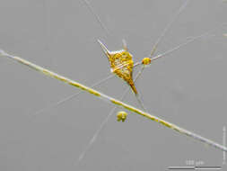
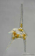
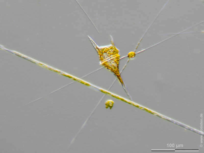
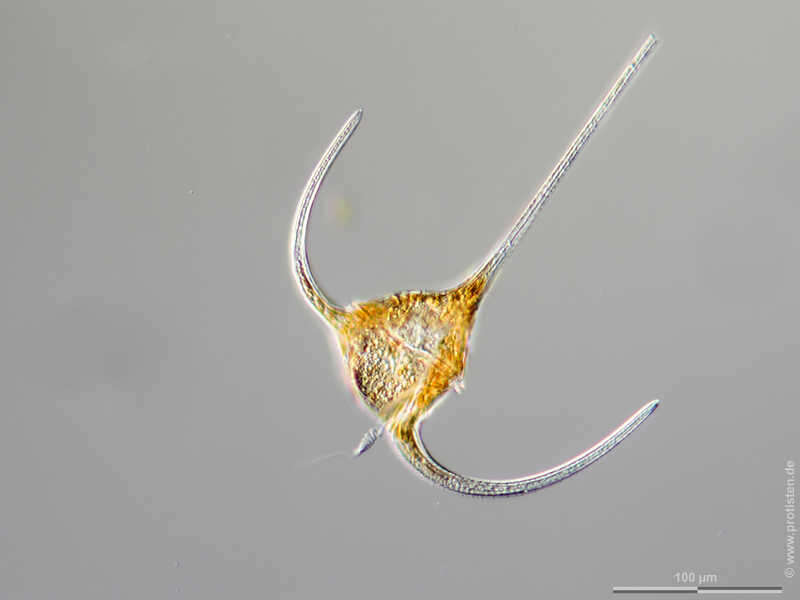
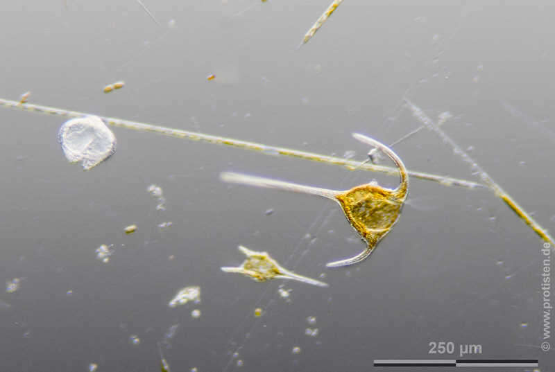
Tripos muelleri Scale bar indicates 100 µm. The specimen was gathered in the Kieler Förde (Baltic Sea). Sampling date 1/2022. The image was built up using several photomicrographic frames with manual stacking technique. Images were taken using Olympus stereo microscope SZX16/Planapo 2.0x with Olympus OM-D M5 MKII. Image under Creative Commons License V 3.0 (CC BY-NC-SA). Place name: Baltic Sea, Kieler Förde, Kiel Fjord (Germany) Latitude: 54.3894126 Longitude: 10.1749055 Multiebenen-Abbildung, manuell gestapelt. Der Messbalken markiert eine Länge von 100 µm. Probe aus der Kieler Förde. Datum der Aufsammlung: 1/2022. Mikrotechnik: Olympus stereo microscope SZX16/Planapo 2.0x, Kamera: Olympus OM-D M5 MKII. Creative Commons License V 3.0 (CC BY-NC-SA). For permission to use of (high-resolution) images please contact postmaster@protisten.de.
-
Tripos muelleri Scale bar indicates 100 µm. The specimen was gathered in the Kieler Förde (Baltic Sea). Sampling date 2/2022. The image was built up using several photomicrographic frames with manual stacking technique. Images were taken using Zeiss Axioplan with Olympus OM-D M5 MKII. Image under Creative Commons License V 3.0 (CC BY-NC-SA). Place name: Baltic Sea, Kieler Förde, Kiel Fjord (Germany) Latitude: 54.3894126 Longitude: 10.1749055 Multiebenen-Abbildung, manuell gestapelt. Der Messbalken markiert eine Länge von 100 µm. Probe aus der Kieler Förde. Datum der Aufsammlung: 3/2022. Mikrotechnik: Olympus stereo microscope SZX16/Planapo 2.0x, Kamera: Olympus OM-D M5 MKII. Creative Commons License V 3.0 (CC BY-NC-SA). For permission to use of (high-resolution) images please contact postmaster@protisten.de.
-
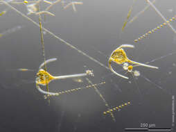
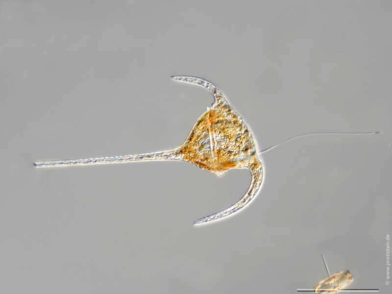
Tripos muelleri Synonym: Ceratium tripos.The specimen was gathered in the Kieler Förde (German Baltic Sea). Scale bar indicates 100 µm. The image was built up using several photomicrographic frames with manual stacking technique. Images were taken using Zeiss Axioplan with MFT camera Olympus OM-D E-M5 II.Image under Creative Commons License V 3.0 (CC BY-NC-SA). Place name: Baltic Sea, Kieler Förde, Kiel Fjord (Germany) Latitude: 54.3894126 Longitude: 10.1749055 Synonym: Ceratium tripos.Multiebenen-Abbildung, manuell gestapelt. Der Messbalken markiert eine Länge von 100 µm. Probe aus der Kieler Förde. Mikrotechnik: Zeiss Axioplan, Kamera: Olympus OM-D E-M5 II. Creative Commons License V 3.0 (CC BY-NC-SA). For permission to use of (high-resolution) images please contact postmaster@protisten.de.
-
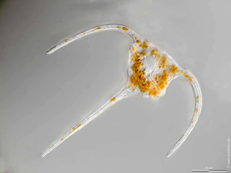
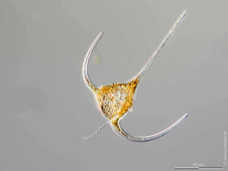
Tripos muelleri Scale bar indicates 50 µm. The specimen was gathered in the Kieler Förde (Baltic Sea). Sampling date 2/2022. The image was built up using several photomicrographic frames with manual stacking technique. Images were taken using Zeiss Axioplan with Olympus OM-D M5 MKII. Image under Creative Commons License V 3.0 (CC BY-NC-SA). Place name: Baltic Sea, Kieler Förde, Kiel Fjord (Germany) Latitude: 54.3894126 Longitude: 10.1749055 Multiebenen-Abbildung, manuell gestapelt. Der Messbalken markiert eine Länge von 50 µm. Probe aus der Kieler Förde. Datum der Aufsammlung: 3/2022. Mikrotechnik: Olympus stereo microscope SZX16/Planapo 2.0x, Kamera: Olympus OM-D M5 MKII. Creative Commons License V 3.0 (CC BY-NC-SA). For permission to use of (high-resolution) images please contact postmaster@protisten.de.
-
Tripos muelleri Synonym: Ceratium tripos.The specimen was gathered in the Kieler Förde (German Baltic Sea). Scale bar indicates 50 µm. The image was built up using several photomicrographic frames with manual stacking technique. Images were taken using Zeiss Axioplan with MFT camera Olympus OM-D E-M5 II.Image under Creative Commons License V 3.0 (CC BY-NC-SA). Place name: Baltic Sea, Kieler Förde, Kiel Fjord (Germany) Latitude: 54.3894126 Longitude: 10.1749055 Synonym: Ceratium tripos.Multiebenen-Abbildung, manuell gestapelt. Der Messbalken markiert eine Länge von 50 µm. Probe aus der Kieler Förde. Mikrotechnik: Zeiss Axioplan, Kamera: Olympus OM-D E-M5 II. Creative Commons License V 3.0 (CC BY-NC-SA). For permission to use of (high-resolution) images please contact postmaster@protisten.de.
-
Tripos muelleri Scale bar indicates 50 µm. The specimen was gathered in the Kieler Förde (Baltic Sea). Sampling date 2/2022. The image was built up using several photomicrographic frames with manual stacking technique. Images were taken using Zeiss Axioplan with Olympus OM-D M5 MKII. Image under Creative Commons License V 3.0 (CC BY-NC-SA). Place name: Baltic Sea, Kieler Förde, Kiel Fjord (Germany) Latitude: 54.3894126 Longitude: 10.1749055 Multiebenen-Abbildung, manuell gestapelt. Der Messbalken markiert eine Länge von 50 µm. Probe aus der Kieler Förde. Datum der Aufsammlung: 3/2022. Mikrotechnik: Olympus stereo microscope SZX16/Planapo 2.0x, Kamera: Olympus OM-D M5 MKII. Creative Commons License V 3.0 (CC BY-NC-SA). For permission to use of (high-resolution) images please contact postmaster@protisten.de.
-
Tripos muelleri Scale bar indicates 100 µm. The specimen was gathered in the Kieler Förde (Baltic Sea). Sampling date 1/2022. The image was built up using several photomicrographic frames with manual stacking technique. Images were taken using Olympus stereo microscope SZX16/Planapo 2.0x with Olympus OM-D M5 MKII. Image under Creative Commons License V 3.0 (CC BY-NC-SA). Place name: Baltic Sea, Kieler Förde, Kiel Fjord (Germany) Latitude: 54.3894126 Longitude: 10.1749055 Multiebenen-Abbildung, manuell gestapelt. Der Messbalken markiert eine Länge von 100 µm. Probe aus der Kieler Förde. Datum der Aufsammlung: 1/2022. Mikrotechnik: Olympus stereo microscope SZX16/Planapo 2.0x, Kamera: Olympus OM-D M5 MKII. Creative Commons License V 3.0 (CC BY-NC-SA). For permission to use of (high-resolution) images please contact postmaster@protisten.de.
-
Tripos muelleri Scale bar indicates 100 µm. The specimen was gathered in the Kieler Förde (Baltic Sea). Sampling date 2/2022. The image was built up using several photomicrographic frames with manual stacking technique. Images were taken using Zeiss Axioplan with Olympus OM-D M5 MKII. Image under Creative Commons License V 3.0 (CC BY-NC-SA). Place name: Baltic Sea, Kieler Förde, Kiel Fjord (Germany) Latitude: 54.3894126 Longitude: 10.1749055 Multiebenen-Abbildung, manuell gestapelt. Der Messbalken markiert eine Länge von 100 µm. Probe aus der Kieler Förde. Datum der Aufsammlung: 3/2022. Mikrotechnik: Olympus stereo microscope SZX16/Planapo 2.0x, Kamera: Olympus OM-D M5 MKII. Creative Commons License V 3.0 (CC BY-NC-SA). For permission to use of (high-resolution) images please contact postmaster@protisten.de.