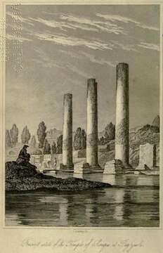
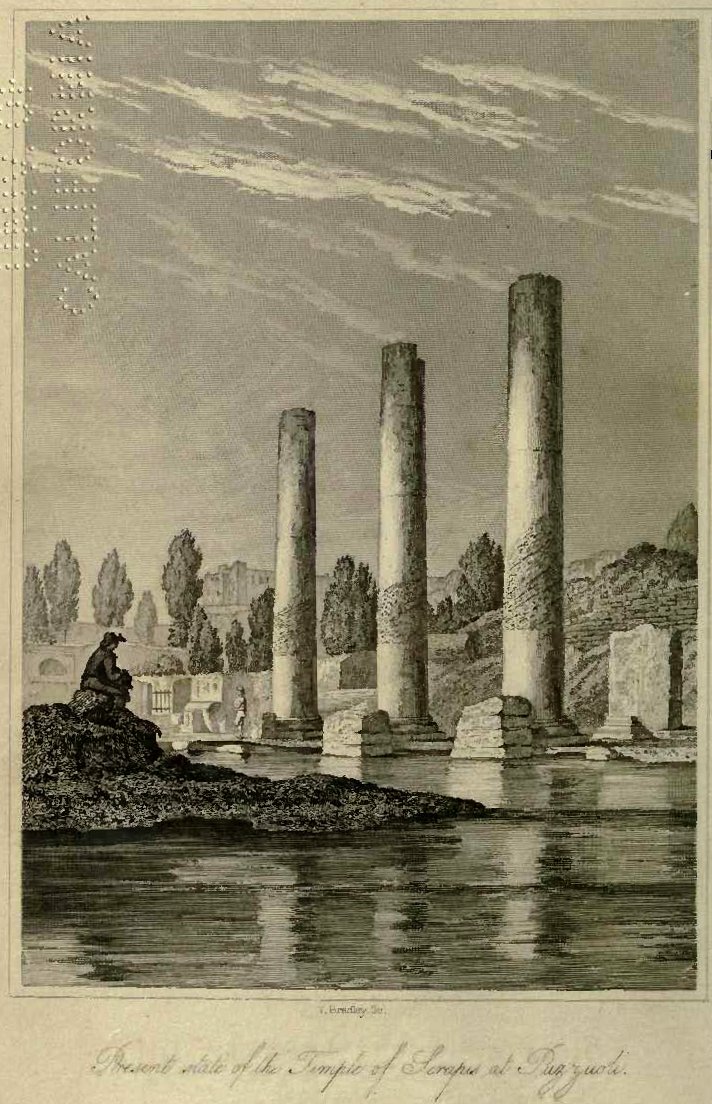
Charles Lyell - Pillars of Pozzuoli
Description:
Camera location 40° 49′ 34″ N, 14° 07′ 14″ E : View all coordinates using: OpenStreetMap - Google Earth: 40.826111; 14.120556. Description: English: Pillars of the temple at Pozzuoli (Italy) used by Lyell to show former sea level differing from today. The corroded part at each pillar has once been below sea level. This higher sea level obviously is after the temple was built and was caused by downwarp and uplift of the land surface as a result of volcanic activity. Date: 1832. Source: Charles Lyell, 1832. Principles of Geology, Vol.1; frontispice. Author: Charles Lyell.
Included On The Following Pages:
- Life
- Cellular
- Eukaryota (eukaryotes)
- Opisthokonta (opisthokonts)
- Metazoa (animals)
- Bilateria
- Protostomia (protostomes)
- Spiralia (spiralians)
- Mollusca (molluscs)
- Bivalvia (mussels)
- Autobranchia
- Pteriomorphia
- Mytilida
- Mytilidae
- Lithophaga (date mussels)
- Lithophaga lithophaga (Date Mussel)
This image is not featured in any collections.
Source Information
- license
- cc-publicdomain
- creator
- Charles Lyell
- source
- Charles Lyell, 1832. Principles of Geology, Vol.1; frontispice
- original
- original media file
- visit source
- partner site
- Wikimedia Commons
- ID