Tiger Bush Niger Corona 1965-12-31

Description:
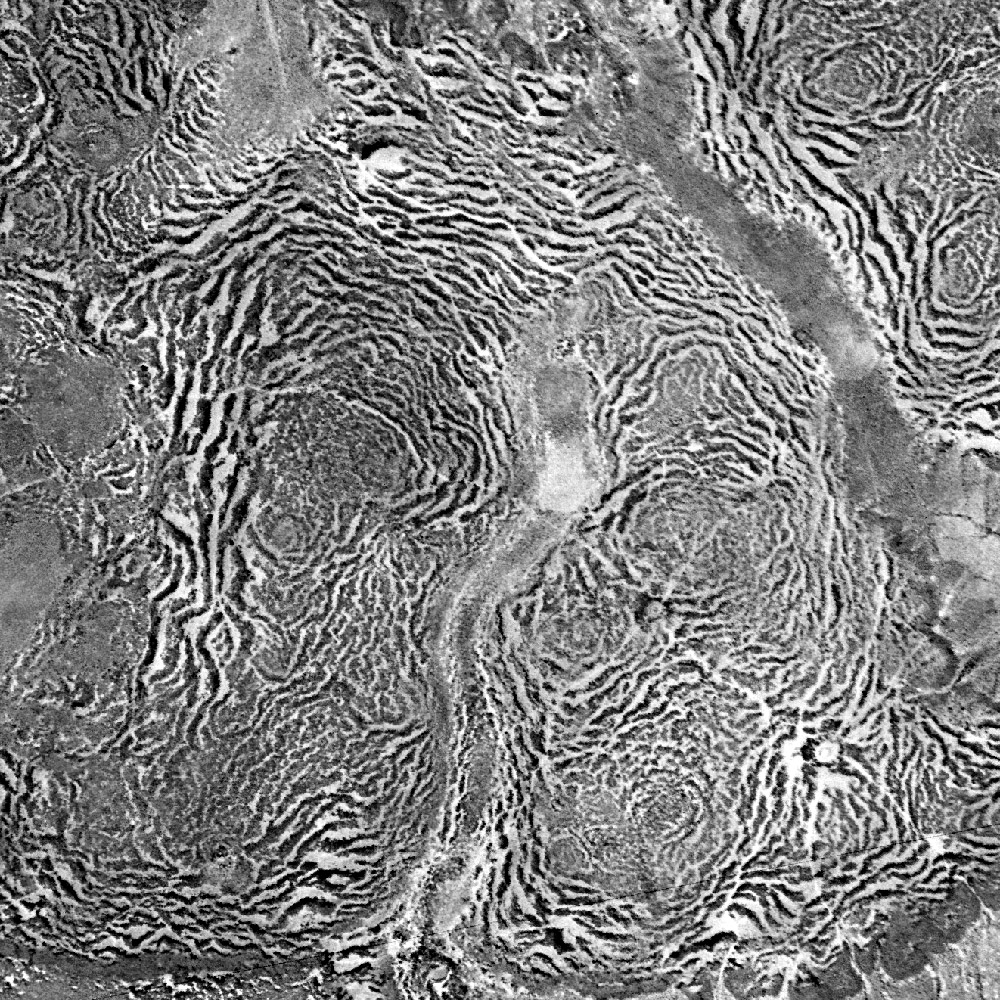
Description: English: Vertical aerial view of a tiger bush plateau in Niger. Vegetation is dominated by Combretum micranthum and Guiera senegalensis. Image size : 5 x 5 km on the ground. Satellite image from the Declassified corona KH-4A national intelligence reconnaissance system, 1965-12-31. Français : Vue aérienne verticale d'une brousse tigrée au Niger le 31 décembre 1965. La végétation est dominée par Combretum micranthum et Guiera senegalensis. L'image couvre 5 x 5 km de terrain. Image satellite Corona KH-4A déclassifiée. Date: 31 December 1965. Source: Data available from the U.S. Geological Survey. Author: US Agency. Camera location14° 14′ 34.8″ N, 2° 41′ 42″ E View all coordinates using: OpenStreetMap 14.243000; 2.695000.
Included On The Following Pages:
- Life
- Cellular
- Eukaryota
- Archaeplastida (plants)
- Chloroplastida
- Streptophyta
- Embryophytes
- Tracheophyta
- Spermatophytes (seed plants)
- Angiosperms (Dicotyledons)
- Eudicots
- Superrosids
- Rosids
- Myrtales
- Combretaceae
- Guiera
- Guiera senegalensis
This image is not featured in any collections.
Source Information
- license
- cc-publicdomain
- creator
- US Agency
- source
- Data available from the U.S. Geological Survey
- original
- original media file
- visit source
- partner site
- Wikimedia Commons
- ID