Drosera kaieteurensis (5)
Description:
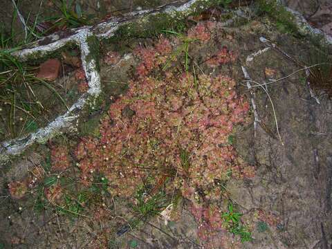
Camera location 5° 58′ 34″ N, 62° 30′ 59.7″ W : View all coordinates using: OpenStreetMap - Google Earth: 5.976112; -62.516584. Description: English: en:Drosera kaieteurensis Deutsch: de:Drosera kaieteurensis Kindly determined by Andreas Fleischmann. Date:. Source: Own work. Author: Morray. English: Please report references to spam@lagrada.de. Deutsch: Quellenangabe und Beleg an spam@lagrada.de erbeten. Español: Por favor mandar informaciones sobre el uso a spam@lagrada.de. Licensing[edit] : This file is licensed under the Creative Commons Attribution 3.0 Unported license.:. You are free: to share – to copy, distribute and transmit the work to remix – to adapt the work Under the following conditions: attribution – You must attribute the work in the manner specified by the author or licensor (but not in any way that suggests that they endorse you or your use of the work). http://creativecommons.org/licenses/by/3.0 CC BY 3.0 Creative Commons Attribution 3.0 truetrue.
Included On The Following Pages:
- Life
- Cellular
- Eukaryota (eukaryotes)
- Archaeplastida (plants)
- Chloroplastida
- Streptophyta
- Embryophytes
- Tracheophyta
- Spermatophytes (seed plants)
- Angiosperms (Dicotyledons)
- Eudicots
- Superasterids
- Caryophyllales
- Droseraceae (sundew family)
- Drosera (Sundews)
- Drosera kaieteurensis
This image is not featured in any collections.
Source Information
- license
- cc-by-3.0
- copyright
- Morray
- creator
- Morray
- original
- original media file
- visit source
- partner site
- Wikimedia Commons
- ID
.jpg)
.jpg)