Image of Austrarchaea thompsoni Rix & Harvey 2012

Description:
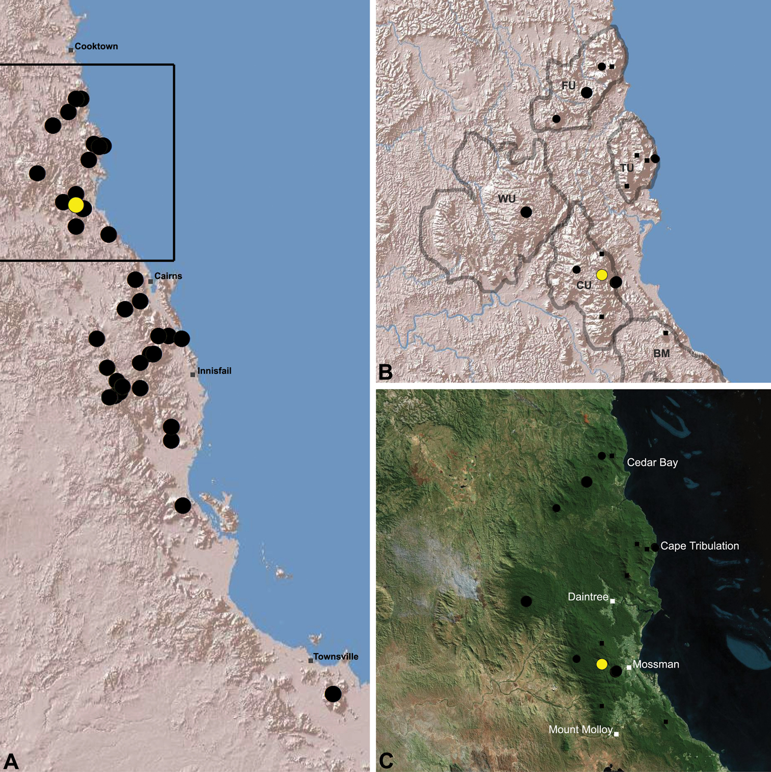
Figure 19.Distribution of Austrarchaea thompsoni sp. n.: A, topographic map showing the known distrib ution of Archaeidae in the north-eastern Queensland Wet Tropics bioregion, with collection localities for Austrarchaea thompsoni highlighted in yellow; B–C, topographic and satellite maps showing detail of inset (A). Labelled boundaries in (B) denote upland subregional zones of faunal endemism identified by Winter et al. (1984), Williams et al. (1996) and other authors for the northern Wet Tropics (modified from Edward 2011). Small squares in (B–C) denote unidentified juvenile specimens; small circles denote unidentified female specimens; large circles denote described species of Austrarchaea. BM = Black Mountain Corridor; CU = Carbine Uplands; FU = Mt Finnigan Uplands; TU = Thornton Uplands; WU = Windsor Uplands.
Included On The Following Pages:
- Life
- Cellular
- Eukaryota
- Opisthokonta
- Metazoa
- Bilateria
- Protostomia
- Ecdysozoa
- Arthropoda (arthropods)
- Chelicerata (spiders)
- Arachnida
- Araneae
- Opisthothelae
- Araneomorphae
- Entelegynae
- Archaeidae
- Austrarchaea
- Austrarchaea thompsoni
- Panarthropoda
This image is not featured in any collections.
Source Information
- license
- cc-by-3.0
- copyright
- Michael G. Rix, Mark S. Harvey
- bibliographic citation
- Rix M, Harvey M (2012) Australian Assassins, Part III: A review of the Assassin Spiders (Araneae, Archaeidae) of tropical north-eastern Queensland ZooKeys 218: 1–50
- original
- original media file
- visit source
- partner site
- Zookeys
- ID